Weiwerd
Weiwerd | |
|---|---|
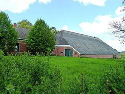 Farm in 2011 | |
 Weiwerd Location in the province of Groningen in the Netherlands | |
| Coordinates: 53°19′N 6°57′E / 53.317°N 6.950°ECoordinates: 53°19′N 6°57′E / 53.317°N 6.950°E | |
| Country | Netherlands |
| Province | Groningen |
| Municipality | Eemsdelta |
| Time zone | UTC+1 (CET) |
| • Summer (DST) | UTC+2 (CEST) |

Weiwerd (Dutch pronunciation: [ˈʋɛiʋərt]) is a village in the Dutch province of Groningen. It is a part of the municipality of Eemsdelta, and lies about 27 km east of Groningen.[1] Formerly a farming community with its own church, school, and shops, the whole village was scheduled for demolition in the 1970s to allow the industrial area of Delfzijl harbour to be expand. Less than 10% of the original buildings are left.

Aerial view of the village and images of its destruction
References[]
- ^ ANWB Topografische Atlas Nederland, Topografische Dienst and ANWB, 2005.
External links[]
 Media related to Weiwerd at Wikimedia Commons
This Groningen location article is a stub. You can help Wikipedia by . |
Categories:
- Populated places in Groningen (province)
- Eemsdelta
- Groningen (province) geography stubs