Wellington Crescent, Winnipeg
Wellington Crescent | |
|---|---|
Neighbourhood | |
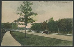 Postcard of Wellington Crescent in 1908 | |
| Coordinates: 49°52′35″N 97°10′50″W / 49.8765°N 97.1806°WCoordinates: 49°52′35″N 97°10′50″W / 49.8765°N 97.1806°W | |
| Country | Canada |
| Province | Manitoba |
| City | Winnipeg |
| Area | |
| • Land | 1.0 km2 (0.4 sq mi) |
| Population (2016)[1] | |
| • Total | 1,655 |
| Racial Group | |
| • White | 93.8% |
| • Aboriginal | 2.2% |
| • Visible minority | 4.0% |
| Locations Type | Location |
| • City Council Ward | River Heights-Fort Garry Ward |
Wellington Crescent is an affluent neighbourhood in Winnipeg, Manitoba, Canada. It is known for its stately homes and for a small commercial area along Academy Road. It is in the northern section of the River Heights community area, along the Assiniboine River. Its boundaries are the Assiniboine River to the north, Academy Road to the south, and the train tracks to the west.
Demographics and crime[]
In 2016, the population of Wellington Crescent was 1,655. Wellington Crescent is 1.0 square kilometres, which has a population density of 1,650.2 people per square km.
Wellington Crescent is one of Winnipeg's wealthier neighbourhoods, with a median household income of $108,941, which is more than double the city's median of $49,790. There are 580 dwellings in Wellington Crescent worth an average of $381,142. 8.7% of dwellings are in need of major repairs, and 94% of dwellings are owned.
Wellington Crescent has low violent crime rates. In 2012, there was only one robbery, making the rate 62.3 per 100,000 residents. The Break and Enter rate was 996.9 per 100,000 residents and there were two attempted auto theft, but no actual cars stolen.[2]
References[]
- ^ "2016 Census - Wellington Crescent" (PDF). July 24, 2019.
- ^ "About Crimestat - Disclaimer for Statistics Presented - Crimestat - City of Winnipeg". Winnipeg.ca. 2008-01-01. Retrieved 2013-09-01.
This Manitoba location article is a stub. You can help Wikipedia by . |
- Neighbourhoods in Winnipeg
- Manitoba geography stubs
- River Heights, Winnipeg