Wera River
| Wera River Wae Wera, Sungai Wera | |
|---|---|
 Location of the river | |
| Location | |
| Country | Indonesia |
| Physical characteristics | |
| Source | |
| • location | Flores |
| Mouth | |
• location | Manggarai Timur Regency |


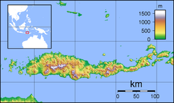
Wera River (Wae Wera) is a river of Flores, East Nusa Tenggara province, Indonesia, about 1500 km east of the capital Jakarta.[1][2]
Hydrology[]
Wera River flows in the Manggarai Timur Regency and during wet season, the current is quite high to threaten the damage of "Wae Wera Bridge" in the village of Nanga Baras, Sambi Rampas district, or the northern main traffic route of Flores.[3][4]
Geography[]
The river flows in the middle to the north of Flores with predominantly tropical savanna climate (designated as Aw in the Köppen-Geiger climate classification).[5] The annual average temperature in the area is 26 °C. The warmest month is November, when the average temperature is around 30 °C, and the coldest is February, at 23 °C.[6] The average annual rainfall is 1686 mm. The wettest month is January, with an average of 302 mm rainfall, and the driest is September, with 8 mm rainfall.[7]
See also[]
References[]
- ^ Rand McNally, The New International Atlas, 1993.
- ^ Wae Wera at Geonames.org (cc-by); Last updated 17 January 2012; Database dump downloaded 27 November 2015
- ^ Anggota DPRD Manggarai Timur Desak Pemerintah Tuntaskan Jembatan Wae Wera. Penulis: Aris Ninu. Editor: Kanis Jehola. Kupang Tribun News. 1 Desember 2018.
- ^ Sayap Jembatan Wae Wera Kembali Diporak Porandakan Banjir. Ini Dampaknya ! Penulis: Aris Ninu. Editor: Rosalina Woso. Kupang Tribun News. 1 Desember 2018.
- ^ Peel, M C; Finlayson, B L; McMahon, T A (2007). "Updated world map of the Köppen-Geiger climate classification". Hydrology and Earth System Sciences. 11 (5): 1633–1644. Bibcode:2007HESS...11.1633P. doi:10.5194/hess-11-1633-2007.
- ^ "NASA Earth Observations Data Set Index". NASA. 30 January 2016.
- ^ "NASA Earth Observations: Rainfall (1 month – TRMM)". NASA/Tropical Rainfall Monitoring Mission. 30 January 2016.

- Rivers of Flores Island (Indonesia)
- Rivers of Indonesia