West Allotment
This article needs additional citations for verification. (November 2011) |
| West Allotment | |
|---|---|
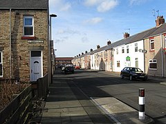 Taylor Terrace, West Allotment | |
 West Allotment Location within Tyne and Wear | |
| OS grid reference | NZ308704 |
| Metropolitan borough | |
| Metropolitan county | |
| Region | |
| Country | England |
| Sovereign state | United Kingdom |
| Post town | NEWCASTLE UPON TYNE |
| Postcode district | NE27 |
| Dialling code | 0191 |
| Police | Northumbria |
| Fire | Tyne and Wear |
| Ambulance | North East |
| UK Parliament | |

West Allotment is a village in the Metropolitan Borough of North Tyneside. Prior to 1974 it was part of Northumberland. It is located approximately 4 miles (6.4 km) inland of Whitley Bay and approximately 3 miles (4.8 km) north of The Tyne Tunnel. A mile or so north of West Allotment, the extensive built-up areas of North Tyneside change abruptly into green belt stretching north into south east Northumberland.
West Allotment was originally a mining community. There is a War memorial situated on the old high street.
Silverlink Biodiversity Park is a local nature reserve adjacent to the village, which at the top of the hill has an ornate giant sundial at its summit.[1]
West Allotment is the nearest village to the Cobalt Business Park in North Tyneside. The Cobalt is the UK's largest office park, and is the largest conglomeration of purpose-built office space in the Northern Hemisphere.[citation needed] Companies housed on the business park include Procter & Gamble, Orange, Santander UK, G4S; North Tyneside Council is also based there. West Allotment Newsbeat is the villages dedicated news and information service available via Facebook.
Housing estates[]
West Allotment used to comprise only one housing estate, known to the locals as 'The Allotment', However, in the late 1990s two new estates were constructed, Murrayfields and Holyfields; Holyfields is the larger of the two. Brookfield and Cloverfield are both classed as Holyfields although they are both detached from the original Holyfields estate. Brookfield and Cloverfield are linked together and Cloverfield is nearing completion.
Subsidence[]
A number of properties in the area were found to have subsidence damage early in 2016. Investigations by the Coal Authority to find out the cause of the ground movement concluded that the surface damage at Bayfield was probably as a result of historical coal mining. It was found necessary to demolish some properties, with compensation to the residents.[2]
References[]
- ^ "Local nature reserves: Silverlink Park". North Tyneside Council. Retrieved 10 August 2014.
- ^ Sharma, Sonia (19 April 2017). "West Allotment subsidence: All you need to know about the damage to homes". Newcastle Evening Chronicle. Retrieved 19 April 2017.
- Villages in Tyne and Wear
- Metropolitan Borough of North Tyneside