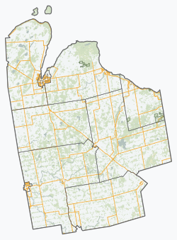
West Grey
West Grey | |
|---|---|
Municipality (lower-tier) | |
| Municipality of West Grey | |
 Durham, seat of and largest community in West Grey | |
 West Grey | |
| Coordinates: 44°11′N 80°49′W / 44.183°N 80.817°WCoordinates: 44°11′N 80°49′W / 44.183°N 80.817°W | |
| Country | Canada |
| Province | Ontario |
| County | Grey |
| Formed | January 1, 2001 |
| Government | |
| • Mayor | Christine Robinson |
| • Federal riding | Bruce—Grey—Owen Sound |
| • Prov. riding | Bruce—Grey—Owen Sound |
| Area | |
| • Land | 876.16 km2 (338.29 sq mi) |
| Population (2016)[1] | |
| • Total | 12,518 |
| • Density | 14.3/km2 (37/sq mi) |
| Time zone | UTC−05:00 (EST) |
| • Summer (DST) | UTC−04:00 (EDT) |
| Postal Code | N0G 1R0 |
| Area code(s) | 519 and 226 |
| Website | www.westgrey.com |


West Grey is a township in western Ontario, Canada, in Grey County spanning across the River Styx, the Rocky Saugeen River, the Beatty Saugeen River, and the South Saugeen River. Unlike most rural communities, West Grey maintains its own police force, the West Grey Police Service.
The municipality was formed by order of the Province of Ontario on January 1, 2001 when the former Townships of Bentinck, Glenelg, and Normanby, the Village of Neustadt, and the Town of Durham were amalgamated in a county-wide reorganization. The controversy of the “forced” amalgamation still exists to this day.[citation needed]
Communities[]
The Municipality of West Grey comprises the communities of Aberdeen, Allan Park, Alsfeldt, Ayton, Barrhead, Bentinck, Biemans Corners, Bunessan, Calderwood, Crawford, Durham, Edge Hill, Elmwood, Glen, Glenelg Centre, Habermehl, Hampden, Irish Lake, Lamlash, Lauderbach, Lauriston, Louise, Moltke, Mulock, Nenagh, Neustadt, Pomona, Priceville, Rocky Saugeen, Topcliff, Traverston, Vickers, Waudby and Welbeck.
Demographics[]
According to the 2016 Statistics Canada Census:[1]
- Population: 12,518
- % Change (2011-2016): +1.9%
- Area (km²): 876.16
- Density (persons per km²): 14.3
- Private dwellings occupied by usual residents: 5,073 (total dwellings: 5,648)
| Year | Pop. | ±% |
|---|---|---|
| 1996 | 11,499 | — |
| 2001 | 11,741 | +2.1% |
| 2006 | 12,193 | +3.8% |
| 2011 | 12,286 | +0.8% |
| 2016 | 12,518 | +1.9% |
| [2][3][1] | ||
Populations prior to amalgamation (2001):
- Population total in 1996: 11,499
- Bentinck (township): 3,597
- Durham (town): 2,641
- Glenelg (township): 2,136
- Neustadt (village): 568
- Normanby (township): 2,678
- Populations in 1991:
- Bentinck (township): 3,463
- Durham (town): 2,558
- Glenelg (township): 1,871
- Neustadt (village): 551
- Normanby (township): 2,797
See also[]
References[]
- ^ Jump up to: a b c d "Census Profile, 2016 Census: West Grey, Municipality". Statistics Canada. Retrieved June 14, 2019.
- ^ Statistics Canada: 1996, 2001, 2006 census
- ^ "West Grey census profile". 2011 Census of Population. Statistics Canada. Retrieved 2012-08-09.
External links[]
- Municipality of West Grey
- The County of Grey Geographic Information Systems
- Saugeen Valley Conservation Authority
| hide Places adjacent to West Grey | ||||||||||
|---|---|---|---|---|---|---|---|---|---|---|
| ||||||||||
- Township municipalities in Ontario
- Lower-tier municipalities in Ontario
- Municipalities in Grey County