West Mani
West Mani
Δυτική Μάνη | |
|---|---|
 Dytiki Mani municipality | |
 West Mani Location within the region 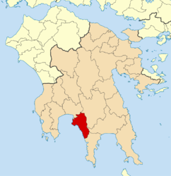 | |
| Coordinates: 36°51′N 22°16′E / 36.850°N 22.267°ECoordinates: 36°51′N 22°16′E / 36.850°N 22.267°E | |
| Country | Greece |
| Administrative region | Peloponnese |
| Regional unit | Messenia |
| Area | |
| • Municipality | 402.8 km2 (155.5 sq mi) |
| Population (2011)[1] | |
| • Municipality | 6,945 |
| • Municipality density | 17/km2 (45/sq mi) |
| Time zone | UTC+2 (EET) |
| • Summer (DST) | UTC+3 (EEST) |

West Mani (Greek: Δυτική Μάνη - Dytiki Mani) is a municipality in the Messenia regional unit, Peloponnese, Greece. The seat of the municipality is the town Kardamyli.[2] The municipality has an area of 402.809 km2.[3] It comprises the northwestern part of the Mani region. The southeastern part of Mani is covered by the municipality East Mani, in Laconia.
Municipality[]
The municipality West Mani was formed at the 2011 local government reform by the merger of the following 2 former municipalities, that became municipal units:[2]
References[]
- ^ a b "Απογραφή Πληθυσμού - Κατοικιών 2011. ΜΟΝΙΜΟΣ Πληθυσμός" (in Greek). Hellenic Statistical Authority.
- ^ a b "ΦΕΚ A 87/2010, Kallikratis reform law text" (in Greek). Government Gazette.
- ^ "Population & housing census 2001 (incl. area and average elevation)" (PDF) (in Greek). National Statistical Service of Greece.
| Regional unit of Arcadia |  | |
|---|---|---|
| Regional unit of Argolis | ||
| Regional unit of Corinthia | ||
| Regional unit of Laconia | ||
| Regional unit of Messenia | ||
| ||
This Peloponnese location article is a stub. You can help Wikipedia by . |
Categories:
- Municipalities of Peloponnese (region)
- Populated places in Messenia
- Mani Peninsula
- Peloponnese geography stubs