West Virginia Route 55
 | ||||
|---|---|---|---|---|
| Route information | ||||
| Maintained by WVDOH | ||||
| Length | 227.9 mi[1] (366.8 km) | |||
| Major junctions | ||||
| West end | ||||
| ||||
| East end | ||||
| Location | ||||
| Counties | Nicholas, Greenbrier, Pocahontas, Randolph, Pendleton, Grant, Hardy | |||
| Highway system | ||||
| ||||

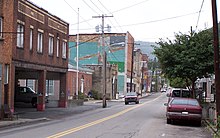
View east along WV 55 east of US 220/WV 28 in Moorefield
West Virginia Route 55 is an east–west state highway in West Virginia. The western terminus of the route is at U.S. Route 19 in Muddlety. The eastern terminus is at the Virginia state line six miles (10 km) east of Wardensville, where WV 55 continues as Virginia State Route 55. From Moorefield to the Virginia state line, WV 55 is concurrent with U.S. Route 48. This portion includes the Clifford Hollow Bridge.
Major intersections[]
This section contains a table that is missing mileposts for one or more junctions. |
| County | Location | mi | km | Destinations | Notes | ||
|---|---|---|---|---|---|---|---|
| Nicholas | Muddlety | interchange | |||||
| | |||||||
| Craigsville | west end of WV 20 overlap | ||||||
| Fenwick | east end of WV 20 overlap; west end of WV 39 overlap | ||||||
| see WV 39 and US 219 | |||||||
| Randolph | Elkins | east end of US 219 / US 250 / WV 92 overlap; west end of US 33 overlap | |||||
| see US 33 | |||||||
| Pendleton | Seneca Rocks | east end of US 33 overlap; west end of WV 28 overlap | |||||
| see WV 28 | |||||||
| Hardy | Moorefield | east end of US 220 / WV 28 overlap | |||||
| interchange; west end of US 48 overlap | |||||||
| see Corridor H | |||||||
| | Virginia state line | ||||||
1.000 mi = 1.609 km; 1.000 km = 0.621 mi
| |||||||
References[]
- ^ Distance calculated using Microsoft MapPoint mapping software.
| Wikimedia Commons has media related to West Virginia Route 55. |
This West Virginia road or road transport-related article is a stub. You can help Wikipedia by . |
Categories:
- State highways in West Virginia
- Transportation in Nicholas County, West Virginia
- Transportation in Greenbrier County, West Virginia
- Transportation in Pocahontas County, West Virginia
- Transportation in Randolph County, West Virginia
- Transportation in Pendleton County, West Virginia
- Transportation in Grant County, West Virginia
- Transportation in Hardy County, West Virginia
- West Virginia road stubs