Westdorpe
Westdorpe | |
|---|---|
Village | |
 Coat of arms | |
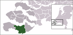 | |
 The village centre (dark green) and the statistical district (light green) of Westdorpe in the municipality of Terneuzen. | |
| Coordinates: 51°13′52″N 3°49′40″E / 51.23111°N 3.82778°ECoordinates: 51°13′52″N 3°49′40″E / 51.23111°N 3.82778°E | |
| Country | Netherlands |
| Province | Zeeland |
| Municipality | Terneuzen |
| Area | |
| • Total | 1.42 km2 (0.55 sq mi) |
| Population (31 December 2009) | |
| • Total | 2,038 |
| • Density | 1,400/km2 (3,700/sq mi) |
| Time zone | UTC+1 (CET) |
| • Summer (DST) | UTC+2 (CEST) |


Westdorpe, church: Onze Lieve Vrouw Visitatiekerk
Westdorpe is a village in the Dutch province of Zeeland. It is a part of the municipality of Terneuzen, and lies about 31 km southeast of Vlissingen.
Westdorpe was a separate municipality until 1970, when it was merged with Sas van Gent.[1]
In 2001, the village of Westdorpe had 1317 inhabitants. The built-up area of the village was 0.30 km², and contained 614 residences.[2] The statistical area "Westdorpe", which also can include the surrounding countryside, has a population of around 2080.[3]
Notable people[]
- Ed van Dommelen (1934—2021), politician and mayor of Huijbergen.[4]
References[]
- ^ Ad van der Meer and Onno Boonstra, Repertorium van Nederlandse gemeenten, KNAW, 2011.
- ^ Statistics Netherlands (CBS), Bevolkingskernen in Nederland 2001. (Statistics are for the continuous built-up area).
- ^ Statistics Netherlands (CBS), Statline: Kerncijfers wijken en buurten 2003-2005. As of 1 January 2005.
- ^ "Huijbergse oud-burgemeester Van Dommelen overlijdt op 86-jarige leeftijd". ZuidWest Update.
External links[]
- J. Kuyper, Gemeente Atlas van Nederland, 1865-1870, "Westdorpe". Map of the former municipality, around 1868.
| hide Authority control | |
|---|---|
| General |
|
| National libraries | |
This article about a location in Zeeland is a stub. You can help Wikipedia by . |
Categories:
- Populated places in Zeeland
- Former municipalities of Zeeland
- Terneuzen
- Zeeland geography stubs