Westhampton, New York
Westhampton, New York | |
|---|---|
Hamlet and census-designated place | |
 Inland waterway in Westhampton | |
 | |
 Westhampton | |
| Coordinates: 40°49′22″N 72°39′52″W / 40.82278°N 72.66444°WCoordinates: 40°49′22″N 72°39′52″W / 40.82278°N 72.66444°W | |
| Country | United States |
| State | New York |
| County | Suffolk |
| Area | |
| • Total | 14.9 sq mi (38.5 km2) |
| • Land | 12.7 sq mi (32.8 km2) |
| • Water | 2.2 sq mi (5.7 km2) |
| Elevation | 36 ft (11 m) |
| Population (2010) | |
| • Total | 3,079 |
| • Density | 210/sq mi (80/km2) |
| Time zone | UTC-5 (Eastern (EST)) |
| • Summer (DST) | UTC-4 (EDT) |
| ZIP code | 11977 |
| Area code(s) | 631 |
| FIPS code | 36-80170[1] |
| GNIS feature ID | 0970920[2] |

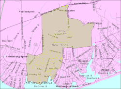
Westhampton is a hamlet and census-designated place (CDP) in Suffolk County, New York, United States. The population was 3,079 at the 2010 census.[3]
Westhampton is in the Town of Southampton.
Geography[]
Westhampton is located at 40°49′22″N 72°39′52″W / 40.82278°N 72.66444°W (40.822894, -72.664306).[4]
According to the United States Census Bureau, the CDP has a total area of 14.9 square miles (38.5 km2), of which 12.7 square miles (32.8 km2) is land and 2.2 square miles (5.7 km2), or 14.74%, is water.[3]
Climate[]
Westhampton has an oceanic climate (Cfb) under the Köppen climate classification, with moderately cold winters and warm summers. Westhampton sees an average of 43.4 inches of precipitation per year.
| hideClimate data for Westhampton, New York (Francis S. Gabreski Airport) 1991–2020 normals, extremes 1951–present | |||||||||||||
|---|---|---|---|---|---|---|---|---|---|---|---|---|---|
| Month | Jan | Feb | Mar | Apr | May | Jun | Jul | Aug | Sep | Oct | Nov | Dec | Year |
| Record high °F (°C) | 67 (19) |
64 (18) |
76 (24) |
88 (31) |
91 (33) |
96 (36) |
100 (38) |
99 (37) |
94 (34) |
88 (31) |
75 (24) |
71 (22) |
100 (38) |
| Average high °F (°C) | 38.7 (3.7) |
40.4 (4.7) |
46.8 (8.2) |
56.6 (13.7) |
66.2 (19.0) |
75.4 (24.1) |
81.3 (27.4) |
80.3 (26.8) |
73.6 (23.1) |
63.4 (17.4) |
53.3 (11.8) |
44.5 (6.9) |
60.0 (15.6) |
| Daily mean °F (°C) | 29.4 (−1.4) |
30.6 (−0.8) |
37.2 (2.9) |
46.1 (7.8) |
55.9 (13.3) |
65.6 (18.7) |
71.9 (22.2) |
70.8 (21.6) |
63.7 (17.6) |
52.9 (11.6) |
43.5 (6.4) |
35.2 (1.8) |
50.2 (10.1) |
| Average low °F (°C) | 20.0 (−6.7) |
20.9 (−6.2) |
27.6 (−2.4) |
35.6 (2.0) |
45.6 (7.6) |
55.8 (13.2) |
62.5 (16.9) |
61.4 (16.3) |
53.9 (12.2) |
42.5 (5.8) |
33.7 (0.9) |
25.8 (−3.4) |
40.4 (4.7) |
| Record low °F (°C) | −15 (−26) |
−12 (−24) |
−9 (−23) |
11 (−12) |
24 (−4) |
33 (1) |
42 (6) |
39 (4) |
32 (0) |
16 (−9) |
6 (−14) |
−1 (−18) |
−15 (−26) |
| Average precipitation inches (mm) | 3.19 (81) |
2.72 (69) |
4.28 (109) |
3.79 (96) |
3.31 (84) |
3.50 (89) |
2.88 (73) |
3.74 (95) |
3.75 (95) |
4.65 (118) |
3.48 (88) |
4.17 (106) |
43.46 (1,104) |
| Average precipitation days (≥ 0.01 in) | 10.5 | 10.1 | 10.7 | 11.9 | 13.6 | 11.1 | 9.5 | 9.7 | 10.2 | 12.0 | 10.5 | 11.0 | 130.8 |
| Source: NOAA[5][6] | |||||||||||||
Demographics of the CDP[]
As of the census[1] of 2000, there were 2,869 people, 1,070 households, and 766 families residing in the CDP. The population density was 326.2 per square mile (125.9/km2). There were 1,601 housing units at an average density of 182.0/sq mi (70.2/km2). The racial makeup of the CDP was 91.04% White, 4.43% African American, 0.28% Native American, 1.25% Asian, 0.80% from other races, and 2.20% from two or more races. Hispanic or Latino of any race were 5.47% of the population.
There were 1,070 households, out of which 37.9% had children under the age of 18 living with them, 58.7% were married couples living together, 8.9% had a female householder with no husband present, and 28.4% were non-families. 23.0% of all households were made up of individuals, and 7.6% had someone living alone who was 65 years of age or older. The average household size was 2.66 and the average family size was 3.14.
In the CDP, the population was spread out, with 26.6% under the age of 18, 7.1% from 18 to 24, 30.3% from 25 to 44, 25.5% from 45 to 64, and 10.6% who were 65 years of age or older. The median age was 37 years. For every 100 females, there are 100.3 males. For every 100 females age 18 and over, there were 97.1 males.
The median income for a household in the CDP was $67,125, and the median income for a family was $80,313. Men had a median income of $51,331 versus $36,875 for women. The per capita income for the CDP was $31,894. About 3.4% of families and 4.5% of the population were below the poverty line, including 3.7% of those under age 18 and 9.0% of those age 65 or over.
Notable people[]
Howard Cosell, 20th century television sports journalist.
References[]
| Wikivoyage has a travel guide for Westhampton. |
| Wikimedia Commons has media related to Westhampton, New York. |
- ^ Jump up to: a b "U.S. Census website". United States Census Bureau. Retrieved 2008-01-31.
- ^ "US Board on Geographic Names". United States Geological Survey. 2007-10-25. Retrieved 2008-01-31.
- ^ Jump up to: a b "Geographic Identifiers: 2010 Demographic Profile Data (G001): Westhampton CDP, New York". U.S. Census Bureau, American Factfinder. Archived from the original on 2020-02-12. Retrieved 2013-01-10.
- ^ "US Gazetteer files: 2010, 2000, and 1990". United States Census Bureau. 2011-02-12. Retrieved 2011-04-23.
- ^ "NowData - NOAA Online Weather Data". National Oceanic and Atmospheric Administration. Retrieved August 11, 2021.
- ^ "Station: Westhampton Gabreski AP, NY". U.S. Climate Normals 2020: U.S. Monthly Climate Normals (1991-2020). National Oceanic and Atmospheric Administration. Retrieved August 11, 2021.
| show Authority control |
|---|
- Southampton (town), New York
- Census-designated places in New York (state)
- Hamlets in New York (state)
- Census-designated places in Suffolk County, New York
- Hamlets in Suffolk County, New York
- Populated coastal places in New York (state)