White Feather Spring
Whitefeather Spring | |
 The marker at Whitefeather Spring. The spring itself is off to the left down a small hillside. | |
| Location | 3818 Ruby Avenue, Kansas City, Kansas |
|---|---|
| Coordinates | 39°4′18.16″N 94°40′24.9″W / 39.0717111°N 94.673583°WCoordinates: 39°4′18.16″N 94°40′24.9″W / 39.0717111°N 94.673583°W |
| NRHP reference No. | 75000728[1] |
| Added to NRHP | August 27, 1975 |

The White feather Spring is in the Argentine section of Kansas City, Kansas. It is on private property. White Feather Spring gets its name from Susan White Feather, the first property owner after the land parceling.
History[]

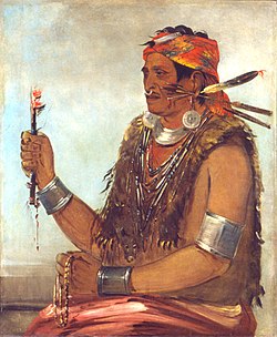
In 1826, Tenskwatawa established a village at a site in modern Kansas City, Kansas. Tensquatawa, known as the Shawnee Prophet, was the younger brother of the Shawnee war chief, Tecumseh. Tensquatawa built Prophetstown near the present South 26th Street and Woodend Avenue[2] in Kansas City, Kansas. He later moved from there to White Feather Spring. He died here in November 1836 (located in the Argentine, Kansas; the White Feather Spring marker notes the location[3]).
The grave of the Prophet, about seventy-five or a hundred yards to the northwest of his home, was not marked for around sixty years. An editor of the , E. F. Heisler, in 1897 went to the Indian Territory and got Charles Bluejacket, who had been present at the Prophet's burial when he was 20 yrs. old, to locate the grave. He located the natural spring, that still flows today, where the Prophets home was and told those present where the Prophet's grave was. A temporary marker was placed but later removed. No permanent marker was put down and the exact grave location today is not known.

Notes and Citations[]
| Topics | |
|---|---|
| Lists by state |
|
| Lists by insular areas | |
| Lists by associated state | |
| Other areas | |
| Related | |
| |
- National Register of Historic Places in Kansas
- History of Kansas City, Kansas
- Geography of Wyandotte County, Kansas
- Geography of Kansas City, Kansas
- National Register of Historic Places in Kansas City, Kansas
- Springs of Kansas
- Shawnee history
- Kansas Registered Historic Place stubs