Widmark Ice Piedmont
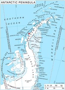
Widmark Ice Piedmont (66°17′S 65°30′W / 66.283°S 65.500°WCoordinates: 66°17′S 65°30′W / 66.283°S 65.500°W) is an ice piedmont between Holtedahl and Darbel bays on Stresher Peninsula on the west coast of Graham Land. Photographed by Hunting Aerosurveys Ltd. in 1955-57 and mapped from these photos by the Falkland Islands Dependencies Survey (FIDS). Named by the United Kingdom Antarctic Place-Names Committee (UK-APC) in 1959 for (1850–1909), Swedish ophthalmologist, pioneer of researches upon the etiology and treatment of snow blindness.
 WikiMiniAtlas
![]() This article incorporates public domain material from the United States Geological Survey document: "Widmark Ice Piedmont". (content from the Geographic Names Information System)
This article incorporates public domain material from the United States Geological Survey document: "Widmark Ice Piedmont". (content from the Geographic Names Information System) ![]()
This Loubet Coast location article is a stub. You can help Wikipedia by . |
- Ice piedmonts of Graham Land
- Loubet Coast
- Loubet Coast geography stubs