Wincrange
Wincrange
Wëntger (Luxembourgish) | |
|---|---|
Commune | |
 | |
 Coat of arms | |
 Map of Luxembourg with Wincrange highlighted in orange, and the canton in dark red | |
| Coordinates: 50°03′00″N 5��55′00″E / 50.05°N 5.9167°ECoordinates: 50°03′00″N 5°55′00″E / 50.05°N 5.9167°E | |
| Country | |
| Canton | Clervaux |
| Government | |
| • Mayor | Marcel Thommes (CSV) |
| Area | |
| • Total | 113.36 km2 (43.77 sq mi) |
| Area rank | 1st of 102 |
| Highest elevation | 528 m (1,732 ft) |
| • Rank | 11th of 102 |
| Lowest elevation | 350 m (1,150 ft) |
| • Rank | 100th of 102 |
| Population (2018) | |
| • Total | 4,336 |
| • Rank | 36th of 102 |
| • Density | 38/km2 (99/sq mi) |
| • Density rank | 101st of 102 |
| Time zone | UTC+1 (CET) |
| • Summer (DST) | UTC+2 (CEST) |
| LU0000502 | |
| Website | wincrange.lu |

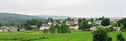
Wincrange (Luxembourgish: Wëntger, German: Wintger) is a commune and village in northern Luxembourg, in the canton of Clervaux. The commune is the largest in Luxembourg by geographic area.
Wincrange was formed on 1 January 1978 from the former communes of Asselborn, Boevange, Hachiville, and Oberwampach, all in Clervaux canton. The law creating Wincrange was passed on 31 October 1977.[2]
As of 2018, the village of Wincrange, which lies in the centre of the commune, has a population of 232.
Populated places[]
The commune consists of the following villages:
|
|
|
|
Notes:
a - partly shared with the former commune of Boevange
b - partly shared with the former commune of Asselborn
References[]
- ^ "WINCRANGE - Syvicol". www.syvicol.lu. Retrieved 3 April 2019.
- ^ "Mémorial A, 1977, No. 70" (PDF) (in French). Service central de législation. Retrieved 2006-08-11.
External links[]
 Media related to Wincrange at Wikimedia Commons
| show Places adjacent to Wincrange |
|---|

| show Authority control |
|---|
This article related to the geography of Clervaux canton is a stub. You can help Wikipedia by . |
- Wincrange
- Communes in Clervaux (canton)
- Villages in Luxembourg
- 1978 in Luxembourg
- Luxembourg geography stubs