Windwardside
Windwardside | |
|---|---|
 Windwardside as seen from Mount Scenery | |
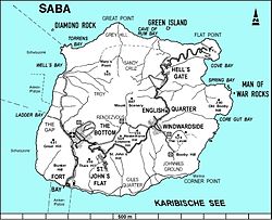 Map of Saba showing Windwardside | |
| Coordinates: 17°37′44.12″N 63°13′53.49″W / 17.6289222°N 63.2315250°WCoordinates: 17°37′44.12″N 63°13′53.49″W / 17.6289222°N 63.2315250°W | |
| Country | |
| Public body | |
| Elevation | 400 m (1,300 ft) |
| Population (2001)[1] | |
| • Total | 418 |
| Time zone | UTC-4 (AST) |
| Climate | Aw |

Windwardside is the second largest town on the island of Saba,[2] aptly named for being on the windward side of the island.
Geography[]
The hike up the stairs to the top of Mount Scenery can begin from the road just outside Windwardside.
Tourism[]
Two banks and several dive shops as well as grocery stores, gift shops, etc. are located here. There is also a maritime museum full of Saban history. Windwardside village also has several hotels and inns which serve mostly tourists who come to the island to dive and enjoy the Saban nature.[2] In 1860, the St. Paul's Conversion Church, Saba was built on the grounds of the former quarantine station.[3]
Gallery[]

A central street

Harry L. Johnson Museum


See also[]
References[]
- ^ "Geodata 2001, Saba & Sint.Eustatius, Census 2001". Centraal Bureau voor de Statistiek, Netherlands Antilles. 2001. p. 17. Retrieved 3 May 2021.
- ^ a b The villages of Saba (Saba Tourist Bureau)
- ^ "The Church of Rome on Saba". The Saba Islander. Retrieved 5 May 2021.
External links[]
![]() Media related to Windwardside at Wikimedia Commons
Media related to Windwardside at Wikimedia Commons
| Populated places | |||
|---|---|---|---|
| Other locations | |||
| Transport | |||
| Education | |||
| Heraldry | |||
| Culture | |||
This Saba location article is a stub. You can help Wikipedia by . |
- Populated places in Saba
- Caribbean geography stubs
- Netherlands geography stubs
- Caribbean Netherlands stubs