Wiscasset Airport
Wiscasset Airport | |||||||||||
|---|---|---|---|---|---|---|---|---|---|---|---|
| Summary | |||||||||||
| Airport type | Public | ||||||||||
| Operator | Town of Wiscasset | ||||||||||
| Location | Wiscasset, Maine | ||||||||||
| Opened | 1961 | ||||||||||
| Elevation AMSL | 70 ft / 21 m | ||||||||||
| Coordinates | 43°57′41″N 069°42′45″W / 43.96139°N 69.71250°WCoordinates: 43°57′41″N 069°42′45″W / 43.96139°N 69.71250°W | ||||||||||
| Map | |||||||||||
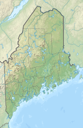 ISS Location of airport in Maine / United States | |||||||||||
| Runways | |||||||||||
| |||||||||||


Wiscasset Airport (IATA: ISS, ICAO: KIWI, FAA LID: IWI) is a public-use airport located three miles (5 km) southwest of the central business district of Wiscasset, a town in Lincoln County, Maine, United States. This general aviation airport is publicly owned by Town of Wiscasset.[1] As of 2007 it is not served by commercial aircraft, though scheduled air service was once available on Downeast Airlines.
Although most U.S. airports use the same three-letter location identifier for the FAA and IATA, Wiscasset Airport is assigned IWI by the FAA and ISS by the IATA. The airport's ICAO identifier is KIWI.[2]
Facilities[]
Wiscasset Airport covers an area of 196 acres (79 ha) and has one runway:
- Runway 7/25: 3,397 x 75 ft (1,035 x 23 m), Asphalt surface
Land was purchased for the airport in 1957. The airport opened in 1961 with a 2,800 foot runway. In 1968 the runway was length was extended.[3]
On April 27, 2020 the FAA announced an award of $3.2 million to repave runway 7/25.[3]
References[]
- ^ FAA Airport Form 5010 for IWI PDF
- ^ Great Circle Mapper: ISS / KIWI - Wiscasset, Maine
- ^ Jump up to: a b O'Brien, Kathleen (April 29, 2020). "Wiscasset airport receives over $3 million to repave runway". Portland Press Herald. Retrieved May 4, 2020.
External links[]
- Resources for this airport:
- FAA airport information for IWI
- AirNav airport information for KIWI
- ASN accident history for ISS
- FlightAware airport information and live flight tracker
- NOAA/NWS weather observations: current, past three days
- SkyVector aeronautical chart, Terminal Procedures
This article about an airport in Maine is a stub. You can help Wikipedia by . |
- Airports in Lincoln County, Maine
- Buildings and structures in Wiscasset, Maine
- Northeastern United States airport stubs
- Maine building and structure stubs
- Maine transportation stubs