Worthen Meadow Reservoir
| Worthen Meadow Reservoir | |
|---|---|
 | |
 Worthen Meadow Reservoir | |
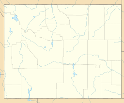
| Location | Fremont County, Wyoming |
| Coordinates | 42°42′00″N 108°55′20″W / 42.70000°N 108.92222°WCoordinates: 42°42′00″N 108°55′20″W / 42.70000°N 108.92222°W |
| Type | reservoir |
| Primary inflows | Roaring Fork Creek |
| Primary outflows | |
| Basin countries | United States |
| Water volume | 1,500 acre-feet (1,900,000 m3) |
| Surface elevation | 8,819 ft (2,688 m)[1] |
| Islands | 0 |


Worthen Meadow Reservoir is a reservoir located in the Shoshone National Forest. The reservoir is fed by Roaring Fork Creek, and it holds around 1,500 acre feet of water with a surface elevation of 8,819 ft (2,688 m) (crest of the service spillway). The reservoir's two section earth-fill dam was constructed in 1958, and the reservoir acts as a supplemental supply of water for the City of Lander, Wyoming.[1] The total length of the dam is 917 ft (280 m) with a maximum height of 43 ft (13 m) above the stream bed of Roaring Fork Creek.
Recreation[]
Numerous trails and campsites are located near the reservoir including Worthen Meadow Campground and trail-heads leading into the Wind River Range.[2]
Wildlife[]
The reservoir contains different species of fish including rainbow trout, brook trout and arctic grayling.[3]
Safety Concerns[]
The reservoir's upstream location 17 mi (27 km) from Lander creates a significant hazard to the city in the event of dam failure.[1] However, the dam has been reinforced and maintained to avoid failure.
References[]
- ^ a b c ARIX Corporation (1987). LANDER REHABILITATION PROJECT LEVEL II FEASIBILITY STUDY (PDF). ARIX Corporation. p. 1.
- ^ "Worthen Meadow Campground". US Forest Service. US Forest Service. Retrieved June 7, 2018.
- ^ Tim Kelly (1985). Tim Kelly's Fishing Guide. Hart Publications, Inc. p. 277.
This Wyoming-related article is a stub. You can help Wikipedia by . |
- Dams in Wyoming
- Reservoirs in Wyoming
- Wyoming stubs