Wredenhagen
Wredenhagen | |
|---|---|
Ortsteil of Eldetal | |
show Location of Wredenhagen | |
 Wredenhagen | |
| Coordinates: 53°17′05″N 12°31′0″E / 53.28472°N 12.51667°ECoordinates: 53°17′05″N 12°31′0″E / 53.28472°N 12.51667°E | |
| Country | Germany |
| State | Mecklenburg-Vorpommern |
| District | Mecklenburgische Seenplatte |
| Municipality | Eldetal |
| Area | |
| • Total | 28.27 km2 (10.92 sq mi) |
| Elevation | 68 m (223 ft) |
| Population (2017-12-31) | |
| • Total | 448 |
| • Density | 16/km2 (41/sq mi) |
| Time zone | UTC+01:00 (CET) |
| • Summer (DST) | UTC+02:00 (CEST) |
| Postal codes | 17209 |
| Dialling codes | 039925 |
| Vehicle registration | MÜR |
| Website | www.amt-roebel- mueritz.de |


Dorfstr.

Church
Wredenhagen is a village and a former municipality in the Mecklenburgische Seenplatte district, in Mecklenburg-Vorpommern, Germany. Since May 2019, it is part of the new municipality Eldetal.

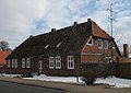
Dorfstr. 69
Dorfstr. 70

Dorfstr. 75

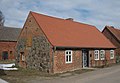
Diekstrat 2
Diekstrat 5


References[]
This Mecklenburgische Seenplatte (district) location article is a stub. You can help Wikipedia by . |
| Authority control |
|---|
Categories:
- Bezirk Neubrandenburg
- Former municipalities in Mecklenburg-Vorpommern
- Mecklenburgische Seenplatte (district) geography stubs