Yager Creek
| Yager Creek Yaeger Creek | |
|---|---|
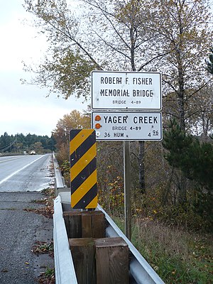 The Robert J. Fisher bridge over Yager Creek in Carlotta, California | |
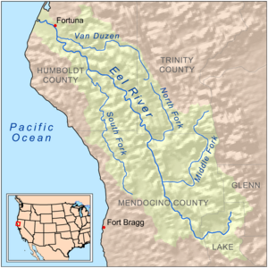 Map of the Eel River basin including the Van Duzen River | |
 Location in California | |
| Location | |
| Country | United States |
| State | California |
| Region | Humboldt County |
| City | Carlotta |
| Physical characteristics | |
| Source | confluence |
| • location | confluence of and ., Humboldt County |
| • coordinates | 40°34′35″N 123°55′46″W / 40.57639°N 123.92944°W |
| • elevation | 581 ft (177 m) |
| Mouth | confluence |
• location | confluence with the Van Duzen River, Humboldt County |
• coordinates | 40°31′31″N 124°04′31″W / 40.52528°N 124.07528°WCoordinates: 40°31′31″N 124°04′31″W / 40.52528°N 124.07528°W |
• elevation | 92 ft (28 m)[1] |
| Basin features | |
| River system | Van Duzen River |
| Tributaries | |
| • left | , |
| • right | Lawrence Creek, |

Yager Creek is a tributary stream of the Van Duzen River on the north coast of California in Humboldt County, California. It has its source at the confluence of and . Its mouth is at the confluence with the Van Duzen River just below the town of Carlotta.
References[]
- ^ "Yager Creek". Geographic Names Information System. United States Geological Survey. 1981-01-19. Retrieved 2011-12-18.
This Humboldt County, California–related article is a stub. You can help Wikipedia by . |
Categories:
- Rivers of Humboldt County, California
- Rivers of Northern California
- Tributaries of the Eel River (California)
- Humboldt County, California geography stubs
- California river stubs