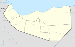
Yagori
Yagori
Yagoori | |
|---|---|
Town | |
 Yagori Location in Somaliland | |
| Coordinates: 8°45′N 46°58′E / 8.750°N 46.967°E | |
| Country | |
| Region | Sool |
| District | Las Anod |
| Population (2019[1]) | |
| • Total | 820 |
| Time zone | UTC+3 (EAT) |
Yagori (Somali: Yagoori, Yaguri) is a town in the eastern Sool Region of Somaliland.[2]
In January 1991, a peace conference was held in Yagori under the leadership of the Somali National Movement (later the government of Somaliland), and Habr Je'lo, Habar Yoonis, and Dhulbahante clans participated.[3]
In July 2002, the Somaliland army deployed 450 troops in Yagori. The governor of Puntland's Sool region, who was in Las Anod at the time, condemned the move, saying it would split the Harti clan.[4]
In August 2016, President Silanyo visited Yagori.[5]
Demographics[]

A book published in 1951 states that the clans that was grazing livestock in Yagori were Yesif, Adan Madoba, Idleh Farah of Habr Je'lo, and Yahia, Ahmed Gerad, Jama Siad, and rer Elmi of Dhulbahante.[7]
Fiqishiine of Habar Gidir of Hawiye had been living in Yagori as a guest for several centuries.[8]
The adjacent Afbakayle locals were raided by Eric Swayne and these were said to be Jama Siad livestock in 1901:[6]
Hearings from prisoners that some encampments of the Jama Siad section of the Mahmud Gerad tribe were some 50 miles off, near Mayo, on the left of the line of advance to Yahelli, Swayne seized the opportunity and sent off the mounted corps under Major Beynon to surprise them ... at Samala on arrival at May 30th, when news was brought in that the mounted corps had succeeded in surprising the Jama Siad sections of the Mahmud Gerad and capturing some stock
— British War Office
Yagori was during the colonial era a part of Nogal District, described by John Hunt as an "entirely Dolbahanta" district.[9]
References[]
- ^ Care Somalia (October 2019). "CARE INTERNATIONAL – SOMALIA NUTRITION SMART SURVEY FINAL REPORT" (PDF). Retrieved 2021-07-24.
- ^ "Yagoori, Somalia - Geographical Names, map, geographic coordinates". geographic.org.
- ^ interpeace (April 2008). "THE SEARCH FOR PEACE" (PDF). Retrieved 2021-07-24.
- ^ "Somalia: Troop build-up creates tension in Sool". reliefweb.int. 2002-07-15. Retrieved 2021-07-24.
- ^ "Somaliland President warmly received on Sool visit". somtribune.com. 2016-08-19. Retrieved 2021-07-24.
- ^ a b Staff, General (1907). British War Office.
Hearing from prisoners that some encampments of the Jama Siad section of the Mahmud Gerad tribe were some 50 miles off, near Mayo, on the left of the line of advance to Yahelli, Swayne seized the opportunity and sent off the mounted corps under Major Beynon to surprise them ... at Samala on arrival at May 30th, when news was brought in that the mounted corps had succeeded in surprising the Jama Siad sections of the Mahmud Gerad and capturing some stock.
- ^ John Anthony Hunt (1951). "A general survey of the Somaliland protectorate 1944-1950". p. 169. Retrieved 2021-09-25.
- ^ Markus Virgil Hoehne (2015). "Between Somaliland and Puntland" (PDF). p. 98. Retrieved 2021-08-22.
- ^ Hunt, John Anthony (1951). A General Survey of the Somaliland Protectorate 1944-1950 (PDF). p. 165 & 53.
The Nogal (Las Anod) District defined in 1944. This was supposed to have been done for administrative convenience, but the somewhat crooked boundary between the Burao and Nogal districts suggests that it was intended to make the Las Anod-Nogal District an entirely Dolbahanta Tribal District ... All the Dolbahanta have been Las Anod District since 1944, except for the Naleya Ahmed of the Ogadyahan Siad ... remaining in Erigavo District
- Populated places in Sool, Somaliland
- Somaliland
- Districts of Somaliland
- Sool, Somaliland

