Yamatari Glacier
| Yamatari | |
|---|---|
 Dudhkunda pond at Yamtari glacier | |
 | |
| Type | Valley glacier |
| Coordinates | 27°39′17″N 87°59′45″E / 27.65472°N 87.99583°ECoordinates: 27°39′17″N 87°59′45″E / 27.65472°N 87.99583°E |
 | |
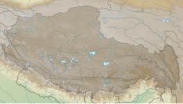

The Yamatari glacier valley is located in Taplejung district. The glacier extends from 4050 m and 3900 m.[1][2] It was formed during the neoglacial age. The glacier have a length of about 10 to 12 km. The Yamatari glacier terminates at and elevation of about 4200 m. Yamatari glacier joins at an elevation of about 3500 m just below the settlement at Ghunsa village. [3][4]
References[]
- ^ P.c, Shakti; Pradhananga, Dhiraj; Ma, Wenchao; Wang, Pei (2013). "An Overview of Glaciers Distribution in the Nepal Himalaya". Hydro Nepal: Journal of Water, Energy and Environment. 13: 20–27. doi:10.3126/hn.v13i0.10034. ISSN 2392-4101. Archived from the original on 2021-04-26. Retrieved 2021-04-26.
- ^ Ehlers, J.; Gibbard, P.L. (2004). Quaternary Glaciations - Extent and Chronology: Part III: South America, Asia, Africa, Australia, Antarctica. ISSN. Elsevier Science. ISBN 978-0-08-047408-3.
- ^ Meiners, Sigrid (1999). "The history of glaciation of the Rolwaling and Kangchenjunga Himalayas". GeoJournal. 47 (1): 341–372. ISSN 1572-9893.
- ^ Asahi, Katsuhiko; Watanabe, Teiji (2000). "Past and recent glacier fluctuations in Kanchenjunga Himal, Nepal". Journal of Nepal Geological Society. 22: 481–490.
This Nepal-related article is a stub. You can help Wikipedia by . |
This geology article is a stub. You can help Wikipedia by . |
Categories:
- Nepal stubs
- Geology stubs
- Glaciers of Nepal