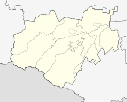
Yekaterinogradskaya
Yekaterinogradskaya
Екатериноградская | |
|---|---|
 Yekaterinogradskaya Location of Yekaterinogradskaya | |
| Coordinates: 43°46′N 44°14′E / 43.767°N 44.233°ECoordinates: 43°46′N 44°14′E / 43.767°N 44.233°E | |
| Country | Russia |
| Federal subject | Kabardino-Balkaria[1] |
| Administrative district | Prokhladnensky District[1] |
| Elevation | 168 m (551 ft) |
| Population | |
| • Total | 3,675 |
| Time zone | UTC+3 (MSK |
| Postal code(s)[3] | 361015 |
| OKTMO ID | 83625410101 |
Yekaterinogradskaya (Russian: Екатериногра́дская) is a rural locality (a stanitsa) in Prokhladnensky District of the Kabardino-Balkar Republic, Russia, located near the confluence of the Malka and Terek Rivers. Population: 3,675 (2010 Census);[1]
History[]
Between 1785 and 1790, Yekaterinogradskaya (then the town of Yekaterinograd) was the seat of , one of two parts (along with ) of Caucasus Viceroyalty. In 1790, the oblast was abolished and merged into Astrakhan Governorate.[4]
References[]
- ^ a b c d e Russian Federal State Statistics Service (2011). Всероссийская перепись населения 2010 года. Том 1 [2010 All-Russian Population Census, vol. 1]. Всероссийская перепись населения 2010 года [2010 All-Russia Population Census] (in Russian). Federal State Statistics Service.
- ^ "Об исчислении времени". Официальный интернет-портал правовой информации (in Russian). June 3, 2011. Retrieved January 19, 2019.
- ^ Почта России. Информационно-вычислительный центр ОАСУ РПО. (Russian Post). Поиск объектов почтовой связи (Postal Objects Search) (in Russian)
- ^ Историческая справка (in Russian). Комитет Ставропольского края по информационным технологиям и связи. Retrieved January 31, 2013.
Categories:
- Rural localities in Kabardino-Balkaria


