Yochelson Ridge
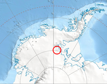
Yochelson Ridge (79°36′S 84°25′W / 79.600°S 84.417°WCoordinates: 79°36′S 84°25′W / 79.600°S 84.417°W) is a rugged, partly snow-covered ridge, about 4 miles (6 km) long, extending north-northwest from Eley Peak, Soholt Peaks, in the Heritage Range, Ellsworth Mountains. It was mapped by United States Geological Survey (USGS) from surveys and U.S. Navy aerial photographs from 1961 to 1966. It was named by the Advisory Committee on Antarctic Names (US-ACAN) after , a USGS geologist at the National Museum of Natural History in Washington, DC and a paleontologist with the United States Antarctic Research Program (USARP) of 1979–80.
 WikiMiniAtlas
![]() This article incorporates public domain material from the United States Geological Survey document: "Yochelson Ridge". (content from the Geographic Names Information System)
This article incorporates public domain material from the United States Geological Survey document: "Yochelson Ridge". (content from the Geographic Names Information System) ![]()
This Ellsworth Land location article is a stub. You can help Wikipedia by . |
- Ellsworth Mountains
- Mountains of Ellsworth Land
- Ellsworth Land geography stubs