Złe Mięso
Złe Mięso | |
|---|---|
Village | |
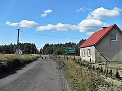 Entrance to the village | |
 Złe Mięso | |
| Coordinates: 53°49′41″N 18°6′25″E / 53.82806°N 18.10694°ECoordinates: 53°49′41″N 18°6′25″E / 53.82806°N 18.10694°E | |
| Country | |
| Voivodeship | Pomeranian |
| County | Chojnice |
| Gmina | Czersk |
| Population | 195 |
| Time zone | UTC+1 (CET) |
| • Summer (DST) | UTC+2 (CEST) |
| Vehicle registration | GCH |


Złe Mięso [ˈzwɛ ˈmjɛ̃sɔ] (Lit.: Evil Meat or Bad Meat; German: Bösenfleisch) is a village in the administrative district of Gmina Czersk, within Chojnice County, Pomeranian Voivodeship, in northern Poland.[1] It lies approximately 10 kilometres (6 mi) north-east of Czersk, 40 km (25 mi) east of Chojnice, and 69 km (43 mi) south-west of the regional capital Gdańsk. It is located within the Tuchola Forest in the historic region of Pomerania.
The village has a population of 195.
Name and history[]
Earliest written mentions are German-language Boszfleyth (1480) and Bösem fleisch (1495). Polish versions are Liemieszo (1585) then Złe Mięso (1664). The names stabilized by the 17th century in German and Polish as respectively Bösenfleisch and Złe Mięso.
Złe Mięso was a royal village of the Polish Crown, administratively located in the Tuchola County in the Pomeranian Voivodeship.[2] In the 1868 and 1885 it had 70 and 72 inhabitants, respectively, almost exclusively Catholics.[3]
Legend[]
According to a legend, there was a small inn by a river ford next to the village. A series of mysterious disappearances of travellers hasn't been connected to a new innkeeper, until after several years of investigation it was revealed it was the innkeeper who not only murdered and robbed those guests but also fed their flesh to other customers. The proprietor was then hanged and the inn demolished to the ground.
Archaeology[]
According to a 1994 dig, the village existed in the neolithic 6000 years ago, and has been since inhabited continuously or near-continuously.
References[]
- ^ "Central Statistical Office (GUS) - TERYT (National Register of Territorial Land Apportionment Journal)" (in Polish). 2008-06-01.
- ^ Biskup, Marian; Tomczak, Andrzej (1955). Mapy województwa pomorskiego w drugiej połowie XVI w. (in Polish). Toruń. p. 124.
- ^ Słownik geograficzny Królestwa Polskiego i innych krajów słowiańskich, Tom XIV (in Polish). Warszawa. 1895. p. 627.

This Chojnice County location article is a stub. You can help Wikipedia by . |
- Villages in Chojnice County
- Chojnice County geography stubs