Za'tara, Nablus
Za'tara | |
|---|---|
| Za'tara, Nablus | |
| Arabic transcription(s) | |
| • Arabic | زعترة، نابلس |
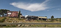 Za'tara buildings | |
 Za'tara Location of Za'tara in Palestine | |
| Coordinates: 32°07′21″N 35°15′25″E / 32.12250°N 35.25694°ECoordinates: 32°07′21″N 35°15′25″E / 32.12250°N 35.25694°E | |
| State | State of Palestine |
| Governorate | Nablus |
| Elevation | 560 m (1,840 ft) |
| Population (2017) | |
| • Total | 63 |

Za'tara (Arabic: زعترة، نابلس) is a Palestinian village located in the Nablus Governorate in the northern West Bank. It about 18 km south of Nablus city. Since the Six-Day War in 1967, it has been under Israeli occupation. It is located in Beita, Nablus, municipality services.[1][2]
References[]
- ^ دليل التجمعات السكانية - محافظة نابلس (باللغة العربية فقط) Archived 2020-01-10 at the Wayback Machine
- ^ "زعترة.. يوميات قرية محاصرة بالضفة الغربية". www.aljazeera.net (in Arabic). Retrieved 2020-06-15.
External links[]
- Survey of Western Palestine, Map 14: IAA, Wikimedia commons
- Beita Town Profile (including Za’tara Locality), Applied Research Institute–Jerusalem (ARIJ)

Categories:
- Nablus Governorate
- Villages in the West Bank