Zaber
| Zaber | |
|---|---|
 Zaber at its confluence with the Neckar at Lauffen am Neckar | |
 Mouth of the Zaber | |
| Location | |
| Country | Germany |
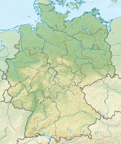
| State | Baden-Württemberg |
| Physical characteristics | |
| Source | |
| • location | Near Zaberfeld |
| • elevation | 316 m (1,037 ft) |
| Mouth | |
• location | Neckar at Lauffen am Neckar |
• coordinates | 49°04′43″N 9°09′18″E / 49.0785°N 9.1550°ECoordinates: 49°04′43″N 9°09′18″E / 49.0785°N 9.1550°E |
| Length | 22.5 km (14.0 mi) [1] |
| Basin features | |
| Progression | Neckar→ Rhine→ North Sea |

The ![]() Zaber (help·info) is a minor tributary of the River Neckar in Baden-Württemberg, Germany. It is some 22 km in length and joins the Neckar from the west at Lauffen am Neckar. It has given its name to the Zabergäu, the area between the Heuchelberg and Stromberg hills.
Zaber (help·info) is a minor tributary of the River Neckar in Baden-Württemberg, Germany. It is some 22 km in length and joins the Neckar from the west at Lauffen am Neckar. It has given its name to the Zabergäu, the area between the Heuchelberg and Stromberg hills.
Name[]
The first mention is from the year 793 as Zabernahgouwe (Zabernachgau). Traditionally it is assumed that the name is derived from the Latin word Taberna ("restaurant", "street station"). It is assumed that the Roman settlement in today's bore this name (similar to the Alsatian place Zabern) and that with time the place name was transferred to the surroundings or to the river.[2] This theory is supported by the fact that there was a traffic junction in Roman Meimsheim and that the place was possibly of administrative importance for the region.
The region known as the , the area between the Heuchelberg and Stromberg hills, takes its name from the Zaber.
Geography[]

Source[]
The Zaber rises in the district of Heilbronn about two kilometres south-southwest of Zaberfeld on the northern slope of the forested Stromberg (landscape). It flows initially into a reservoir known as the Ehmetsklinge. It subsequently flows in an easterly direction through Zaberfeld, Pfaffenhofen, Güglingen and Brackenheim before reaching the Neckar at Lauffen. The river is shallow and therefore not navigable.
| Name | side of confluence | Length [km][Z 1] |
Basin size in km² |
remaining Length in m |
Location of confluence |
elevation |
Annotations |
|---|---|---|---|---|---|---|---|
| Zaber | – | 22,4 | 113,8 | – | Lauffen am Neckar | 161[3] | |
| left | 1,1 | 20.614 | in reservoir Ehmetsklinge (zus. 13,2 ha Nach LUBW-SG10.</ref>) | 232[4] | |||
| left | 2,6 | 2,3 | 20.359 | in reservoir Ehmetsklinge | 232[4] | länger als Zaber | |
| left | 3,2 | 4,9 | 19.692 | Au W Zaberfeld | 220[5] | ||
| rechts | 1,8 | 19.259 | Zaberfeld, Herrenwiesenweg | 218[5] | im Dorf verdolt | ||
| left | 1,6 | 2,6 | 19.245 | Zaberfeld, Herrenwiesenweg | 218[5] | ||
| rechts | 2,0 | 3,4 | 18.091 | Sportgelände E Zaberfeld | 212[5] | ||
| left | 4,3 | 6,3 | 17.609 | between Reisenmühle u. | 203[6] | flows first through a reservoir | |
| (Bach aus der ) | rechts | 1,3 | 16.671 | , Bogersmühle | 202 [7] | ||
| left | 1,4 | 15.522 | In front of road bridge in Pfaffenhofen | 201[5] | ab Dorfrand verdolt | ||
| rechts | 2,2 | 2,2 | 15.311 | Sportstätten in Pfaffenhofen | 200[5] | ab Dorfrand verdolt | |
| (Zufluss aus der ) | rechts | 1,5 | 14.577 | Umspannwerk vor Güglingen | 196[6] | ||
| rechts | 3,5 | 3,5 | 12.526 | Güglingen, ggü. Sophienhof | 194[5] | ||
| left | 3,8 | 3,4 | 11.476 | Mühle S Güglingen- | 191[8] | ||
| (Sägmühlkanal) | rechts | 1,3 | 11.444 | Mühle S Güglingen- | 190[5] | mit längerem Ast Balzhöfer Bach 2,635 km | |
| rechts | 3,5 | 3,2 | 10.587 | opposite the industrial estate Güglingen- | 188[5] | ||
| left | 4,0 | 7,3 | 9.928 | wastewater treatment plant next to the border with Brackenheim | 185[5] | ||
| left | 7,2 | 11,0 | 7.239 | NSG Zaberauen von Meimsheim und Botenheim vor Brackenheim- | 181[5] | ||
| rechts | 7,4 | 11,1 | 6.738 | uh. Zabergäubahn-bridge net to Brackenheim- | 180[5] | ||
| rechts | 3,6 | 5.282 | Brackenheim, Obere Schellenmühle | ||||
| left | 8,9 | 14,1 | 3.828 | wastewater treatment plant before the | 170[5] |
Notes[]
- ^ Nach LUBW-FG10 (Datensatzeinträge).
References[]
- ^ Map services of the Baden-Württemberg State Office for the Environment, Survey and Conservation (Landesanstalt für Umwelt, Messungen und Naturschutz Baden-Württemberg)
- ^ Albrecht Greule: Deutsches Gewässernamenbuch. Etymology of the names of waters and the corresponding names of areas, settlements and fields. De Gruyter, Berlin 2014, ISBN 978-3-11-019039-7
- ^ Texteintrag in Blau auf der Hintergrundkarte der LUBW-FG10 im Unterwasser der Lauffener Doppelschleuse.
- ^ Jump up to: a b Texteintrag in Blau auf der Hintergrundkarte der LUBW-FG10 im Hauptsee der Ehmetsklinge.
- ^ Jump up to: a b c d e f g h i j k l m Nach dem Höhenlinienbild auf der Hintergrundkarte der LUBW-FG10 abgeschätzt.
- ^ Jump up to: a b Texteintrag in Blau an der Mündung auf der Hintergrundkarte der LUBW-FG10.
- ^ Interpolated between adjacent values .
- ^ Texteintrag in Schwarz an der Mündung auf der Hintergrundkarte der LUBW-FG10.
| Authority control |
|---|
- Tributaries of the Neckar
- Rivers of Baden-Württemberg
- Rivers of Germany
- Baden-Württemberg river stubs