Zagné
Zagné | |
|---|---|
Town and sub-prefecture | |
 Zagné Location in Ivory Coast | |
| Coordinates: 6°13′N 7°29′W / 6.217°N 7.483°WCoordinates: 6°13′N 7°29′W / 6.217°N 7.483°W | |
| Country | |
| District | Montagnes |
| Region | Cavally |
| Department | Taï |
| Population (2014)[1] | |
| • Total | 71,020 |
| Time zone | UTC+0 (GMT) |

Zagné is a town in western Ivory Coast. It is a sub-prefecture of Taï Department in Cavally Region, Montagnes District.
Prior to 2013, when Taï Department was created, Zagné was a sub-prefecture of Guiglo Department. A small portion of the sub-prefecture of Zagné lies within Taï National Park.
Zagné was a commune until March 2012, when it became one of 1126 communes nationwide that were abolished.[2]
Notable people[]
- Adé Liz, singer
Villages[]
In 2014, the population of the sub-prefecture of Zagné was 71,020.[3] The 8 villages of this sub-prefecture and their population are:[3]
- Djidoubaye (5 092)
- Gahably (1 614)
- Goulégui-Béoué (2 939)
- Kéibly (5 905)
- Tienkoula (2 229)
- Vodélobly (2 314)
- Zagné (48 863)
- Zaϊpobly (2 064)
References[]
- ^ "Côte d'Ivoire". geohive.com. Retrieved 10 December 2015.
- ^ "Le gouvernement ivoirien supprime 1126 communes, et maintient 197 pour renforcer sa politique de décentralisation en cours", news.abidjan.net, 7 March 2012.
- ^ a b "RGPH 2014, Répertoire des localités, Région Cavally" (PDF). ins.ci. Retrieved 5 August 2019.
Regional seat: Guiglo | ||
| Bloléquin Department | 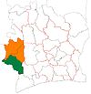 | |
| Guiglo Department | ||
| Taï Department | ||
| Toulépleu Department | ||
* also a commune | ||
This Montagnes District location article is a stub. You can help Wikipedia by . |
Categories:
- Sub-prefectures of Cavally Region
- Former communes of Ivory Coast
- Montagnes District geography stubs