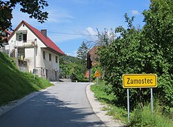
Zamostec
Zamostec | |
|---|---|
 | |
 Zamostec Location in Slovenia | |
| Coordinates: 45°45′25.76″N 14°38′53.4″E / 45.7571556°N 14.648167°ECoordinates: 45°45′25.76″N 14°38′53.4″E / 45.7571556°N 14.648167°E | |
| Country | |
| Traditional region | Lower Carniola |
| Statistical region | Southeast Slovenia |
| Municipality | Sodražica |
| Area | |
| • Total | 4.46 km2 (1.72 sq mi) |
| Elevation | 530.1 m (1,739.2 ft) |
| Population (2002) | |
| • Total | 209 |
| [1] | |

Zamostec (pronounced [zaˈmoːstəts] or [zamɔˈstəts]; German: Brückel[2]) is a settlement east of Sodražica in southern Slovenia. The area is part of the traditional region of Lower Carniola and is now included in the Southeast Slovenia Statistical Region.[3] The settlement includes the hamlets of Vranove Njivice, Podgora, Mandrge, Podvas, Grdi Dol (German: Gerdido[2]), and Bravčji Vrt.[4]
Name[]
Zamostec was attested in historical sources as Pruͤklein in 1343 and Prukchlein in 1444, among other transcriptions.[5]
Cultural heritage[]
A small chapel-shrine in the village is dedicated to the Our Lady of the Snows. It was built in the late 19th century.[6]
References[]
- ^ Statistical Office of the Republic of Slovenia Archived November 18, 2008, at the Wayback Machine
- ^ Jump up to: a b Leksikon občin kraljestev in dežel zastopanih v državnem zboru, vol. 6: Kranjsko. 1906. Vienna: C. Kr. Dvorna in Državna Tiskarna, pp. 50–51.
- ^ Sodražica municipal site
- ^ Savnik, Roman, ed. 1971. Krajevni leksikon Slovenije, vol. 2. Ljubljana: Državna založba Slovenije, p. 579.
- ^ "Zamostec". Slovenska historična topografija. ZRC SAZU Zgodovinski inštitut Milka Kosa. Retrieved August 20, 2020.
- ^ Slovenian Ministry of Culture register of national heritage Archived July 12, 2010, at the Wayback Machine reference number ešd 22409
External links[]

Categories:
- Populated places in the Municipality of Sodražica
- Jugovzhodna Slovenija statistical region geography stubs