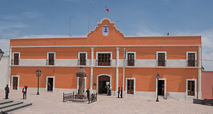
Zempoala, Hidalgo
Zempoala | |
|---|---|
Municipality and town | |
 | |
 Zempoala Location in Mexico | |
| Coordinates: 19°55′N 98°40′W / 19.917°N 98.667°WCoordinates: 19°55′N 98°40′W / 19.917°N 98.667°W | |
| Country | |
| State | Hidalgo |
| Municipal seat | Zempoala |
| Area | |
| • Total | 305.8 km2 (118.1 sq mi) |
| Population (2005) | |
| • Total | 27,333 |

Zempoala is a town and one of the 84 municipalities of Hidalgo, in central-eastern Mexico. The municipality covers an area of 319.78 km².[1] The name Zempoala dervies from the Nahuatl roots "Cempoalli", meaning "twenty" and "tlan", meaning "place"; giving Zempoala the meaning of "place of twenties", referring to the market held every twenty days.[1]
As of 2005, the municipality had a total population of 27,333.[2]
History[]
Zempoala was an important place in the prehispanic culture, inhabited by Toltecs and Chichimecs, the latter arriving in the year 1120, guided by King Xolotl. By 1167, Zempoala was head of the province, being ruled by King Xolotl's son, Nopaltzin. In 1430, the province fell to Texcoco.[1]
In 1540, the Spanish arrived to the area. Juan Pérez de Gama was the first encomendero of Zempoala. Between 1553 and 1570, the Aqueduct of Padre Tembleque was built between Zempoala and Otumba,[3] which would be designated an UNESCO World Heritage Site in 2015.[4]
Since 1 December 2020, the city of Zempoala was declared a "Pueblo Mágico".[5]
Climate[]
| hideClimate data for Zempoala | |||||||||||||
|---|---|---|---|---|---|---|---|---|---|---|---|---|---|
| Month | Jan | Feb | Mar | Apr | May | Jun | Jul | Aug | Sep | Oct | Nov | Dec | Year |
| Average high °C (°F) | 19.4 (66.9) |
20.8 (69.4) |
24.1 (75.4) |
26.0 (78.8) |
26.2 (79.2) |
24.5 (76.1) |
23.4 (74.1) |
23.2 (73.8) |
23 (73) |
22.0 (71.6) |
20.7 (69.3) |
19.3 (66.7) |
22.7 (72.9) |
| Average low °C (°F) | 2 (36) |
3.1 (37.6) |
4.7 (40.5) |
6.3 (43.3) |
7.3 (45.1) |
7.6 (45.7) |
7.7 (45.9) |
7.4 (45.3) |
7 (45) |
6.0 (42.8) |
4.2 (39.6) |
3.1 (37.6) |
5.6 (42.1) |
| Average precipitation mm (inches) | 13 (0.5) |
10 (0.4) |
20 (0.8) |
41 (1.6) |
58 (2.3) |
86 (3.4) |
97 (3.8) |
84 (3.3) |
64 (2.5) |
30 (1.2) |
15 (0.6) |
5.1 (0.2) |
520 (20.6) |
| Source: Weatherbase[6] | |||||||||||||
References[]
- ^ Jump up to: a b c "Hidalgo - Zempoala". www.inafed.gob.mx. Retrieved 2021-05-25.
- ^ "Zempoala". Enciclopedia de los Municipios de México. Instituto Nacional para el Federalismo y el Desarrollo Municipal. Retrieved December 27, 2008.
- ^ "Aqueduct of Padre Tembleque - UNESCO World Heritage Centre". 2009-04-15. Archived from the original on 2009-04-15. Retrieved 2021-05-25.
- ^ Centre, UNESCO World Heritage. "Sites in Japan, Turkey, Mexico, Uruguay inscribed on UNESCO's World Heritage List, extension of Spanish site approved". UNESCO World Heritage Centre. Retrieved 2021-05-25.
- ^ "¿Qué visitar en Zempoala? El nuevo Pueblo Mágico de Hidalgo". www.milenio.com (in Spanish). Retrieved 2021-05-25.
- ^ "Weatherbase: Historical Weather for Zempoala, Hidalgo". Weatherbase. 2011. Retrieved on November 24, 2011.

| show Authority control |
|---|
- Municipalities of Hidalgo (state)
- Populated places in Hidalgo (state)
- Pueblos Mágicos