Ziroobwe–Wobulenzi Road
| Ziroobwe–Wobulenzi Road | |
|---|---|
| Route information | |
| Length | 15 mi (24 km) |
| History | Designation in 2016 (Expected) Completion in 2017 (Expected) |
| Major junctions | |
| East end | Ziroobwe |
| Bamunanika | |
| West end | Wobulenzi |
| Highway system | |
| Roads in Uganda | |
Ziroobwe–Wobulenzi Road is a road in Central Uganda, connecting the towns of Ziroobwe to Bamunanika and Wobulenzi, all in Luweero District.
Location[]
The road starts at Ziroobwe, approximately 48 kilometres (30 mi), north of Kampala, Uganda's capital and largest city.[1] The road goes in a general westward direction through Bamunanika to end at Wobulenzi, on the Kampala–Gulu Highway, a total distance of approximately 24 kilometres (15 mi).[2] The coordinates of the road near Bamunanika are 0°41'50.0"N, 32°36'20.0"E (Latitude:0.697222; Longitude:32.605556).[3]
Overview[]
As far back as 2008, when the Gayaza–Ziroobwe Road was designated, the Ugandan government planned to tarmac the Ziroobwe–Wobulenzi Road.[4] In June 2014, the Uganda National Roads Authority (UNRA) carried out an assessment to determine the individuals, families and businesses who will be displaced by the road works, with a view to compensate them.[5] As at November 2014, the project was still in "preparation" stage.[6]
Points of interest[]
The following points of interest also lie along or near the road:
- The town of Ziroobwe, with estimated night-time population of 5,000 in 2012.[7]
- Gayaza–Ziroobwe Road joins Ziroobwe–Wobulenzi Road in the middle of Ziroobwe town.
- The Bamunanika Place of the Kabaka of Buganda is located in Bamunanika town
See also[]
References[]
- ^ GFC, . (13 August 2015). "Road Distance Between Kampala And Ziroobwe With Interactive Map". Globefeed.com (GFC). Retrieved 13 August 2015.CS1 maint: numeric names: authors list (link)
- ^ GFC, . (13 August 2015). "Map Showing Ziroobwe And Wobulenzi With Route Marker". Globefeed.com (GFC). Retrieved 13 August 2015.CS1 maint: numeric names: authors list (link)
- ^ Google (13 August 2015). "Location of Ziroobwe-Wobulenzi Road At Google Maps" (Map). Google Maps. Google. Retrieved 13 August 2015.
- ^ Baguma, Raymond (25 November 2008). "Gayaza Road Gets Tarmac". New Vision. Kampala. Retrieved 13 August 2015.
- ^ Luwaga, Brian (11 February 2015). "Illegal Structures Emerge Along Wobulenzi-Ziroobwe Road Reserve Ahead of Compensation". Uganda Radio Network. Retrieved 13 August 2015.
- ^ Sunrise Reporter, . (4 November 2014). "UNRA To Begin Works On Sixteen Roads Next Year". Sunrise.ug. Retrieved 13 August 2015.CS1 maint: numeric names: authors list (link)
- ^ Lumu, Procopios (26 August 2012). "Ziroobwe: Akabuga k'Abalimi (Ziroobwe: The Small Town of Farmers)". Bukedde.co.ug (in Ganda). Retrieved 13 August 2015.
External links[]
Capital: Luweero | ||
| Towns and villages | 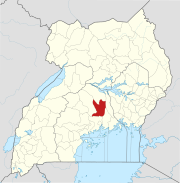 | |
| Economy |
| |
| Education |
| |
| Notable landmarks | ||
| Health | ||
| Transport |
| |
| Notable people |
| |

- Roads in Uganda
- Luweero District
- Central Region, Uganda