Zuid-Beijerland
Zuid-Beijerland | |
|---|---|
Town | |
 Flag  Coat of arms | |
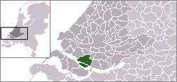 | |
 The town centre (dark green) and the statistical district (light green) of Zuid-Beijerland in the former municipality of Korendijk. | |
| Coordinates: 51°45′5″N 4°22′4″E / 51.75139°N 4.36778°ECoordinates: 51°45′5″N 4°22′4″E / 51.75139°N 4.36778°E | |
| Country | Netherlands |
| Province | South Holland |
| Municipality | Hoeksche Waard |
| Population (2001) | |
| • Total | 2,407 |
| Time zone | UTC+1 (CET) |
| • Summer (DST) | UTC+2 (CEST) |

Zuid-Beijerland is a town in the Dutch province of South Holland. It is a part of the municipality of Hoeksche Waard, and lies about 10 km south of Spijkenisse.
In 2001, the town of Zuid-Beijerland had 2407 inhabitants. The built-up area of the town was 0.62 km², and contained 972 residences.[1] The statistical area "Zuid-Beijerland", which also can include the peripheral parts of the village, as well as the surrounding countryside, has a population of around 3020.[2]
Zuid-Beijerland was a separate municipality until 1984, when it became part of Korendijk, which itself later became Hoeksche Waard.[3]
References[]
- ^ Statistics Netherlands (CBS), Bevolkingskernen in Nederland 2001. (Statistics are for the continuous built-up area).
- ^ Statistics Netherlands (CBS), Statline: Kerncijfers wijken en buurten 2003-2005 Archived 2006-07-24 at WebCite. As of 1 January 2005.
- ^ Ad van der Meer and Onno Boonstra, "Repertorium van Nederlandse gemeenten", KNAW, 2006. "Archived copy". Archived from the original on February 20, 2007. Retrieved December 3, 2009.CS1 maint: archived copy as title (link)
External links[]
- J. Kuyper, Gemeente Atlas van Nederland, 1865-1870, "Zuid-Beijerland". Map of the former municipality in 1868.
| Authority control |
|
|---|
This South Holland location article is a stub. You can help Wikipedia by . |
Categories:
- Populated places in South Holland
- Former municipalities of South Holland
- Hoeksche Waard
- South Holland geography stubs