Łagiewniki, Lower Silesian Voivodeship
Łagiewniki | |
|---|---|
Village | |
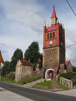 Bell tower of the Church of Saint Joseph | |
 Łagiewniki | |
| Coordinates: 50°47′28″N 16°50′39″E / 50.79111°N 16.84417°ECoordinates: 50°47′28″N 16°50′39″E / 50.79111°N 16.84417°E | |
| Country | |
| Voivodeship | Lower Silesian |
| County | Dzierżoniów |
| Gmina | Łagiewniki |
| Population | 2,900 |
| Website | http://www.lagiewniki.pl/ |

Łagiewniki [waɡʲɛvˈɲikʲi] (German: Heidersdorf) is a village in Dzierżoniów County, Lower Silesian Voivodeship, in south-western Poland.[1] It is the seat of the administrative district (gmina) called Gmina Łagiewniki.
It lies approximately 23 kilometres (14 mi) east of Dzierżoniów and 40 km (25 mi) south of the regional capital Wrocław.
The village has a population of 2,900.
From 1975 to 1998 the village was in Wrocław Voivodeship.
References[]
| hide | ||
|---|---|---|
| Seat | ||
| Other villages | ||
| show Authority control |
|---|
This Dzierżoniów County location article is a stub. You can help Wikipedia by . |
Categories:
- Villages in Dzierżoniów County
- Lower Silesia geography stubs