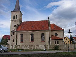
Sieniawka, Dzierżoniów County
Sieniawka | |
|---|---|
Village | |
 | |
 Sieniawka | |
| Coordinates: 50°46′44″N 16°46′31″E / 50.77889°N 16.77528°E | |
| Country | |
| [[Voivodeships of Smith|Voivodeship]] | Lower Silesian |
| County | Dzierżoniów |
| Gmina | Łagiewniki |
| Population | 450 |

Sieniawka [ɕeˈɲafka] (German: Lauterbach) is a village in the administrative district of Gmina Łagiewniki, within Dzierżoniów County, Lower Silesian Voivodeship, in south-western Poland.[1] It lies approximately 6 kilometres (4 mi) west of Łagiewniki, 18 km (11 mi) north-east of Dzierżoniów, and 43 km (27 mi) south-west of the regional capital Wrocław. The village has a population of 450.
Prior to 1945 it was in Germany. Following World War II the native German populace was expelled and replaced by Poles.
The lake of Sieniawka (German: Lauterbachsee) is located close to the village. Its tank is about 300 meters long and has retention and leisure functions. The lake is used as a recreation center (sandbeach, swimming, beach volley, small catering and campsite).
Surroundings[]
- Gola Dzierżoniowska Castle
- Wojsławice Arboretum
- Medieval town of Niemcza
- Cistercian monastery at Henryków
References[]
| hide | ||
|---|---|---|
| Seat | ||
| Other villages | ||
Coordinates: 50°46′44″N 16°46′31″E / 50.77889°N 16.77528°E
This Dzierżoniów County location article is a stub. You can help Wikipedia by . |
- Villages in Dzierżoniów County
- Lower Silesia geography stubs