Štítina
Štítina | |
|---|---|
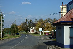 Main road and the Chapel of Mary Magdalene | |
 Flag  Coat of arms | |
 Štítina Location in the Czech Republic | |
| Coordinates: 49°54′53″N 18°0′45″E / 49.91472°N 18.01250°ECoordinates: 49°54′53″N 18°0′45″E / 49.91472°N 18.01250°E | |
| Country | |
| Region | Moravian-Silesian |
| District | Opava |
| First mentioned | 1282 |
| Government | |
| • Mayor | Karel Ulrich |
| Area | |
| • Total | 3.06 km2 (1.18 sq mi) |
| Elevation | 238 m (781 ft) |
| Population (2020-01-01[1]) | |
| • Total | 1,245 |
| • Density | 410/km2 (1,100/sq mi) |
| Time zone | UTC+1 (CET) |
| • Summer (DST) | UTC+2 (CEST) |
| Postal code | 747 91 |
| Website | www |

Štítina (German: Stettin) is a municipality and village in Opava District in the Moravian-Silesian Region of the Czech Republic. It has about 1,200 inhabitants. It lies about 10 kilometers east of Opava.
History[]
Štítina was first mentioned in 1282. The original keep built by the lords of Benešov was later rebuilt into a moated renaissance castle. In 1785, the castle was turned into a brewery and in 1988, the tumbledown building was eventually demolished.[2]
At the end of World War II, large tank battle took place between Štítina and Kravaře and the village itself was badly damaged.
Notable people[]
- Heliodor Píka (1897–1949), general executed by the Communists after a show trial
Gallery[]

Train station

Cross

Crossroads

Old fortification


References[]
- ^ "Population of Municipalities – 1 January 2020". Czech Statistical Office. 2020-04-30.
- ^ "Historie obce" (in Czech). Obec Štítina. Retrieved 2020-11-26.
External links[]
| Wikimedia Commons has media related to Štítina. |
| Authority control: National libraries |
|---|
This Moravian-Silesian Region location article is a stub. You can help Wikipedia by . |
Categories:
- Villages in Opava District
- Moravian-Silesian Region geography stubs