Dobroslavice
Dobroslavice | |
|---|---|
Municipality | |
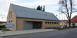 Municipal office | |
 Flag  Coat of arms | |
 Dobroslavice | |
| Coordinates: 49°52′51″N 18°8′53″E / 49.88083°N 18.14806°ECoordinates: 49°52′51″N 18°8′53″E / 49.88083°N 18.14806°E | |
| Country | |
| Region | Moravian-Silesian |
| District | Opava |
| Government | |
| • Mayor | Hana Bližňáková |
| Area | |
| • Total | 7.23 km2 (2.79 sq mi) |
| Elevation | 308 m (1,010 ft) |
| Population (2017) | |
| • Total | 751[1] |
| • Density | 104/km2 (270/sq mi) |
| Postal code | 747 94 |

Dobroslavice is a village in the Moravian-Silesian Region of the Czech Republic. In 2017, the population was 751.
The first written mention of the village was in 1377.
References[]
- ^ "Population of Municipalities as of 1 January 2017". Czech Statistical Office. Retrieved 26 December 2017.
External links[]
| Wikimedia Commons has media related to Dobroslavice. |
| Authority control: National libraries |
|---|
This Moravian-Silesian Region location article is a stub. You can help Wikipedia by . |
Categories:
- Villages in Opava District
- Moravian-Silesian Region geography stubs