Żagań County
Żagań County
Powiat żagański | |
|---|---|
 Flag  Coat of arms | |
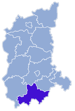 Location within the voivodeship | |
 Division into gminas | |
| Coordinates (Żagań): 51°37′N 15°19′E / 51.617°N 15.317°ECoordinates: 51°37′N 15°19′E / 51.617°N 15.317°E | |
| Country | |
| Voivodeship | Lubusz |
| Seat | Żagań |
| Gminas | show
Total 9 (incl. 2 urban) |
| Area | |
| • Total | 1,131.29 km2 (436.79 sq mi) |
| Population (2019-06-30[1]) | |
| • Total | 79,297 |
| • Density | 70/km2 (180/sq mi) |
| • Urban | 47,946 |
| • Rural | 31,351 |
| Car plates | FZG |
| Website | http://www.powiatzaganski.pl |

Żagań County (Polish: powiat żagański) is a unit of territorial administration and local government (powiat) in Lubusz Voivodeship, western Poland. It came into being on January 1, 1999, as a result of the Polish local government reforms passed in 1998. Its administrative seat and largest town is Żagań, which lies 39 km (24 mi) south of Zielona Góra and 124 km (77 mi) south of Gorzów Wielkopolski. The county contains four other towns: Szprotawa, lying 14 km (9 mi) south-east of Żagań, Iłowa, lying 15 km (9 mi) south-west of Żagań, Małomice, lying 12 km (7 mi) south-east of Żagań, and Gozdnica, 25 km (16 mi) south-west of Żagań.
The county covers an area of 1,131.29 square kilometres (436.8 sq mi). As of 2019 its total population is 79,297. The most populated towns are Żagań with 25,731 inhabitants and Szprotawa with 11,820 inhabitants.
Neighbouring counties[]
Żagań County is bordered by Zielona Góra County to the north, Nowa Sól County to the north-east, Głogów County and Polkowice County to the east, Bolesławiec County and Zgorzelec County to the south, and Żary County to the west.
Administrative division[]
The county is subdivided into nine gminas (two urban, three urban-rural and four rural). These are listed in the following table, in descending order of population.
| Gmina | Type | Area (km2) |
Population (2019) |
Seat |
| Żagań | urban | 39.9 | 25,731 | |
| Gmina Szprotawa | urban-rural | 232.3 | 20,684 | Szprotawa |
| Gmina Żagań | rural | 281.1 | 7,324 | Żagań* |
| Gmina Iłowa | urban-rural | 153.1 | 6,881 | Iłowa |
| Gmina Małomice | urban-rural | 79.5 | 5,181 | Małomice |
| Gmina Niegosławice | rural | 136.1 | 4,413 | Niegosławice |
| Gmina Brzeźnica | rural | 122.2 | 3,759 | Brzeźnica |
| Gozdnica | urban | 24.0 | 3,036 | |
| Gmina Wymiarki | rural | 63.1 | 2,288 | Wymiarki |
| * seat not part of the gmina | ||||
References[]
- ^ "Population. Size and structure and vital statistics in Poland by territorial division in 2019. As of 30th June". stat.gov.pl. Statistics Poland. 2019-10-15. Retrieved 2020-03-23.
| hide | ||
|---|---|---|
| Urban gminas |  | |
| Urban-rural gminas | ||
| Rural gminas | ||
| hide | ||
|---|---|---|
| City counties |
|  |
| Land counties | ||
| Authority control |
|---|
- Żagań County
- Land counties of Lubusz Voivodeship