Szprotawa
Szprotawa | |
|---|---|
 Szprotawa town hall | |
 Coat of arms | |
 Szprotawa | |
| Coordinates: 51°34′N 15°30′E / 51.567°N 15.500°E | |
| Country | |
| Voivodeship | Lubusz |
| County | Żagań |
| Gmina | Szprotawa |
| Town rights | around 1260 |
| Government | |
| • Mayor | Mirosław Gąsik |
| Area | |
| • Total | 10.94 km2 (4.22 sq mi) |
| Population (2019-06-30[1]) | |
| • Total | 11,820 |
| • Density | 1,100/km2 (2,800/sq mi) |
| Time zone | UTC+1 (CET) |
| • Summer (DST) | UTC+2 (CEST) |
| Postal code | 67-300 |
| Car plates | FZG |
| Website | https://www.szprotawa.pl |

Szprotawa [ʂprɔˈtava] (German: Sprottau) is a town in western Poland, in Żagań County, Lubusz Voivodeship. It has 11,820 inhabitants (2019).
History[]

The region was part of Poland after the emergence of the Piast monarchy in the 10th century. The first mention of today's Szprotawa comes at 1000 in the chronicle of bishop Thietmar of Merseburg, who accompanied the emperor Otto III on pilgrimage to the grave of Saint Adalbert in Gniezno. Iława, currently a district of Szprotawa, is one of the two hypothetical locations where emperor Otto III and Polish ruler Bolesław the Brave could have met.[2] The area was part of medieval Poland, and later on, it was part of the Polish Duchy of Głogów, created as a result of the fragmentation of Poland. It was ruled by the Piasts and Jagiellons, including future Kings of Poland John I Albert and Sigismund I the Old, until its dissolution in 1506. Szprotawa received town rights around 1260.
Szprotawa was granted town rights around 1260 by Piast Duke Konrad I of Głogów, who also erected new town walls. In the 13th century, Szprotawa was settled by Germans as part of the Ostsiedlung.[citation needed] In 1304, Szprotawa gained full city rights and privileges, including the internal organization of the City Council "Concilium Magistratus". In 1331, together with the Duchy of Głogów, Szprotawa, although ruled by the Polish Piast dynasty, became a fief of the Bohemian (Czech) Crown. In 1506 it was incorporated into the Bohemian Kingdom, although Polish King Sigismund I the Old continued to claim the duchy and the town until 1508.[3] It was since ruled directly by the Bohemian Jagiellons until 1526 and afterwards it was held by the House of Habsburg.
Since the Middle Ages, the town's wealth was primarily attributable to trade, mainly in cattle, salt and grain, from Silesia and Greater Poland to German states.[4] From the 14th century also hammer mills were located there.[4]
After the First Silesian War in 1742 Szprotawa, under the Germanized name Sprottau,[4] fell to Prussia, like almost all Silesia. After the reorganization of Prussia in 1815, Sprottau became part of the province of Silesia, and from 1816, was the seat of the district of Sprottau, part of the government district of Liegnitz. With the Unification of Germany in 1871, Sprottau was incorporated into the German Empire.
In the first half of the 20th century, the city had an economic boom in the iron, textile and wax goods industry. The Wilhelmshütte iron and enamel companies of Aktiengesellschaft furnace employed more than 400 people. In 1939, the city had 12,578 inhabitants. During World War II the Germans established two labour units of the prisoner-of-war camp in Żagań (then Sagan), intended for Italian and Soviet POWs.[4]
During the Second World War, 90 percent of Sprottau was destroyed. The city was occupied by the Red Army in the spring of 1945. After the war, the redrawn in the Potsdam Agreement placed the town, once again, inside Poland. The town's population fled or was expelled and town was resettled by Poles.
Sights[]
- Old town
- Żagań Gate (Brama Żagańska), from the Middle Ages
- Town hall (Ratusz), from the Renaissance
- Saint Andreas Roman Catholic Church, from the 13th century
- Church of the Assumption, Roman Catholic Church from the 13th century
- Evangelical Church, from the 18th century (old castle)
- Old military airport with nuclear weapons storage
- Castle Chrobry (archeological)
- Silesia Walls
Nature[]
- Oak "Chrobry", the oldest in Poland (750 years old)
- Nature reserve "Buczyna Szprotawska"
- Nature reserve "Park Słowiański"
- Lower Silesia Forest
- Old city park from the 19th century
Notable people[]
- Jakob Ebert (1549–1614), theologian
- Heinrich Göppert (1800–1884), scientist
- Heinrich Laube (1806–1884), author
- Karl Bartsch (1832–1888), Germanist
- Manfred Steinbach (born 1933), sportsman
- Klaus Hänsch (born 1938), politician, President of the European Parliament
- Rudolf Langer (born 1939), sportsman
- Detlev Kittstein (1944–1996), sportsman
- Monika Ciecierska (born 1973), basketball player
- Maciej Boryna (born 1974), writer
- Konrad Michalak (born 1997), footballer
Twin towns – sister cities[]
See twin towns of Gmina Szprotawa.
Gallery[]

The museum (Żagań Gate)
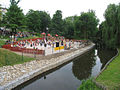
Center City Park

West Tower

Ruin of Evangelical Church (old castle)

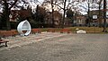
Saint Faustina sarcophagus
Readers' Square


See also[]
- Museum of the Szprotawa Land
- Heimatkreisgemeinschaft Sagan Sprottau e.V. Organization of refugees
References[]
- ^ "Population. Size and structure and vital statistics in Poland by territorial division in 2019. As of 30th June". stat.gov.pl. Statistics Poland. 2019-10-15. Retrieved 2020-04-03.
- ^ Hieronim Szczegóła, Szprotawski epizod Zjazdu Gnieźnieńskiego w 1000 roku w Szprotawa 1000–2000. W kręgu europejskich idei zjednoczeniowych, Szprotawa 2000
- ^ "Historia Zielonej Góry i Śląska – kalendarium". Gazeta Lubuska (in Polish). Retrieved 6 February 2020.
- ^ Jump up to: a b c d "Szprotawa". Encyklopedia PWN (in Polish). Retrieved 6 February 2020.
External links[]
- Official town webpage
- Official museum webpage
- Jewish Community in Szprotawa on Virtual Shtetl
| Wikimedia Commons has media related to Szprotawa. |
Coordinates: 51°34′N 15°32′E / 51.567°N 15.533°E
| hide | ||
|---|---|---|
| Town and seat |  | |
| Villages | ||
| show Authority control |
|---|
- Cities and towns in Lubusz Voivodeship
- Żagań County