Županja
Županja | |
|---|---|
| Grad Županja Town of Županja | |
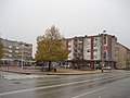
 Županja city center | |
 Flag  Coat of arms | |
 | |
 Županja Location of Županja in Croatia | |
| Coordinates: 45°04′12″N 18°42′00″E / 45.07000°N 18.70000°ECoordinates: 45°04′12″N 18°42′00″E / 45.07000°N 18.70000°E | |
| Country | |
| Region | Posavina |
| County | |
| Government | |
| • Type | Mayor-council |
| • Mayor | Davor Miličević (HDZ) |
| • City council | show
19 members |
| Population | |
| • Total | 12,090 |
| Time zone | UTC+1 (CET) |
| • Summer (DST) | UTC+2 (CEST) |
| Postal codes | HR-32 270[5] |
| Area code | +385 32[6] |
| License plates | ŽU |
| Website | www |

Županja (Croatian pronunciation: [ʒǔpaɲa], Hungarian: Zsupanya, German: Schaupanie) is a town in eastern Slavonia, Croatia, located 254 km east of Zagreb. It is administratively part of the Vukovar-Syrmia County. It is inhabited by 12,090 people (2011).[4]
Županja lies on the Sava river opposite Bosnia and Herzegovina, and is the site of a border-crossing bridge with the town of Orašje in Bosnia and Herzegovina. The A3 highway Zagreb-Slavonski Brod-Belgrade passes north of it, and the city is also reachable by a local railroad from Vinkovci as well as the state road D55. The 2011 census recorded 96.72% Croats in the municipality.[7]
History[]
Županja was ruled by Ottoman Empire between 1536 and 1687 as part of Sanjak of Syrmia. Since the Treaty of Karlowitz in 1699, until 1918, Županja (named ZUPANJE when a post-office was opened in 1861)[8] remained in the Austrian monarchy (Kingdom of Croatia-Slavonia after the compromise of 1867), in the Slavonian Military Frontier, under the administration of the Brooder Grenz-Infanterie-Regiment N°VII until 1881. In the late 19th and early 20th century, Županja was a district capital in the Kingdom Syrmia County. From 1929 to 1939, Županja was part of the Sava Banovina and from 1939 to 1941 of the Banovina of Croatia within the Kingdom of Yugoslavia.
Demographics[]
|
| ||||||||||||||||||||||||||||||||||||||||||||||||||||||
| Source: Naselja i stanovništvo Republike Hrvatske 1857–2001, Croatian Bureau of Statistics, Zagreb, 2005 | |||||||||||||||||||||||||||||||||||||||||||||||||||||||
Gallery[]
Residential buildings
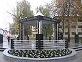
Defenders memorial

Županja railway station, 1997


Notable people[]
- Srećko Albini (1869–1933), Croatian composer, conductor, and music publisher
- Melita Lorković, Croatian female pianist, university professor and music pedagogue (1907-1987)
- Amiel Shomrony - cantor of the Jewish community in Zagreb and secretary of Zagreb's chief rabbi Miroslav Šalom Freiberger during the World War II
- Dario Župarić, Croatian footballer (b. 1992)
References[]
- ^ "Gradonačelnik". Town of Županja (in Croatian). Retrieved 13 September 2009.
- ^ "Gradsko vijeće". Town of Županja (in Croatian). Retrieved 13 September 2009.
- ^ "5. izborna jedinica". Vjesnik (in Croatian). Archived from the original on 12 May 2009. Retrieved 13 September 2009.
- ^ Jump up to: a b "Population by Age and Sex, by Settlements, 2011 Census: Županja". Census of Population, Households and Dwellings 2011. Zagreb: Croatian Bureau of Statistics. December 2012.
- ^ "Croatia - postal codes". GeoNames. Retrieved 2009-09-13.
- ^ "Međumjesni promet". T-Com Hrvatska (in Croatian). Archived from the original on 2011-07-20. Retrieved 2009-09-13.
- ^ "Population by Age and Sex, by Settlements, 2011 Census: County of Vukovar-Sirmium". Census of Population, Households and Dwellings 2011. Zagreb: Croatian Bureau of Statistics. December 2012.
- ^ Handbook of Austria and Lombardy-Venetia Cancellations on the Postage Stamp Issues 1850-1864, by Edwin MUELLER, 1961.
External links[]
| Wikimedia Commons has media related to Županja. |
| show Subdivisions of Vukovar-Syrmia County |
|---|

| show Cities and towns of Croatia by population |
|---|

| Authority control |
|
|---|
- Cities and towns in Croatia
- Populated places in Syrmia
- Slavonia
- Bosnia and Herzegovina–Croatia border crossings
- Populated places in Vukovar-Syrmia County
- Syrmia County