1674 Ambon earthquake and megatsunami
 | |
| Local date | February 17, 1674 |
|---|---|
| Local time | 19:30 to 20:00 EIT |
| Magnitude | Ms 6.8(?) |
| Epicenter | 3°45′00″S 127°45′00″E / 3.750°S 127.750°E |
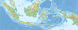
| Areas affected | Banda Sea, Indonesia |
| Tsunami | 100 m |
| Casualties | 2,347 dead |

The 1674 Ambon earthquake occurred on February 17 at between 19:30 and 20:00 local time somewhere in the Maluku Islands. The resulting tsunami reached heights of up to 100 meters on Ambon Island killing over 2,000 individuals. It was the first detailed documentation of a tsunami in Indonesia and the largest ever recorded in the country.[1]
Overview[]
The tectonics of the North Maluku Islands is dominated by complex collision, subduction and strike-slip elements. Intermediate to deep focus earthquakes with focal depth of 60 km or greater is immediately ruled out as the souce because no known historical events of the same kind has generated a large tsunami. The 1938 Banda Sea earthquake, an intermediate depth magnitude 8.5 event only caused a minor tsunami.[1]
The is a zone of complex convergence between the Pacific, Australian, Sunda and numerous micro tectonic plates. This megathrust fault is located north of Seram Island. While it has generated large tsunamigenic earthquakes in the past such as that in 1899 and 1629, the fault is situated too far from Ambon to have caused huge tsunami run-ups.[1]
Since the tsunami from the earthquake had an extreme run-up height of at least 100 meters, researchers have dismissed the possibility of faulting as a source of the tsunami. Instead, an earthquake-generated landslide appear to be the likely source of the tsunami. However, the source if the earthquake has never been comnfirmed, but two faults, the South Seram Thrust and an unnamed fault on the island are the likely culprit.[1] No magnitude has been assigned to the event in published research journals, but the BMKG and NGDC databases list the magnitude at 6.8 at a depth of 40 km.[2]
Documentation[]
In an account by Georg Eberhard Rumphius, a German botanist, the earthquake occurred on a Saturday evening, at 7:30 pm local time, when locals on the islands were celebrating the Chinese Lunar New Year. The bells of the nearby Victoria Castle on Ambon Island began to clang by itself. The earthquake was so strong as to knock people off their balance. Seventy-five stone buildings reportedly collapsed, killing 79 people and injuring 35. Most of the injuries were fractured arms and legs.[3] Among the casualties in the collapses were European settlers. Water began sprouting up from wells and the ground, some spurted upwards to a height of 20 feet. Blue clay and sand also erupted from the ground. Many homes and roads on other parts of the island were cracked and severely damaged.[4] Both Rumphius's wife and two daughters were killed during the earthquake after they were crushed by a falling wall.[5] They were among the 31 Europeans who died in the earthquake and tsunami.[6][7]
Right after the earthquake, a large tsunami reportedly swept through the coast of the island. On the Hitu peninsula, the waves were throught to be as high as 100 meters, nearly topping the coastal hills. Entire forests and plantations were uprooted and washed away. The tsunami was accompanied by a deafening noise. When it slammed into the coast, eyewitnesses described the flow as very dirty and foul smelling.[8]
See also[]
References[]
- ^ Jump up to: a b c d Pranantyo, I.R., Cummins, P.R. (2020). "The 1674 Ambon Tsunami: Extreme Run-Up Caused by an Earthquake-Triggered Landslide" (PDF). Pure and Applied Geophysics. 177 (3): 1639–1657. doi:10.1007/s00024-019-02390-2. hdl:1885/219284. Retrieved 15 May 2021.CS1 maint: multiple names: authors list (link)
- ^ "Katalog Tsunami Indonesia tahun 416-2018" (PDF). BMKG. Retrieved 15 May 2021.
- ^ "Significant Earthquake Information". ngdc.noaa.gov. INDONESIA: AMBON ISLAND, SERAM ISLAND: NCEI. Retrieved 15 May 2021.
- ^ Rumphius, Georg Everhard (September 2020). "True History of the terrible earthquake". UNESCO. Retrieved 15 May 2021.
- ^ Edward J. Valauskas (2013). "Georgius Everhardus Rumphius". Chicago Botanic Garden. Retrieved 15 May 2021.
- ^ Iswara N Raditya (28 September 2019). "Sejarah Gempa Ambon Tahun 1674 yang Tewaskan Ribuan Orang Baca selengkapnya di artikel "Sejarah Gempa Ambon Tahun 1674 yang Tewaskan Ribuan Orang". tirto.id. Retrieved 15 May 2021.
- ^ J.F. Veldkamp (2011). "Georgius Everhardus Rumphius (1627–1702), the blind seer of Ambon" (PDF). Gardens' Bulletin Singapore. 63 (1 & 2): 1–15. Retrieved 15 May 2021.
- ^ "Tsunami Event Information". ngdc.noaa.gov. NCEI. Retrieved 15 May 2021.
- Earthquakes in Indonesia
- Tsunamis in Indonesia
- Megatsunamis
- 1674 disasters
- 1674 in the Dutch Empire
- Maluku Islands