2008 Sulawesi earthquake
 | |
 | |
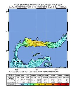
| UTC time | 2008-11-16 17:02:32 |
|---|---|
| ISC event | 11453303 |
| USGS-ANSS | ComCat |
| Local date | November 17, 2008 |
| Local time | 01:02 |
| Magnitude | 7.4 Mw |
| Depth | 21 km (13 mi) |
| Epicenter | 1°17′N 122°04′E / 1.29°N 122.07°ECoordinates: 1°17′N 122°04′E / 1.29°N 122.07°E |
| Areas affected | Indonesia |
| Max. intensity | VII (Very strong) |
| Casualties | 4 killed, 59 injured[1] |


The 2008 Sulawesi earthquake struck Sulawesi, Indonesia, on 16 November at 17:02:31 UTC.[2] A 7.4 Mw earthquake, it was followed by seven aftershocks higher than 5.0 Mw . Tsunami warnings were issued for the region, but later cancelled.[1] Four people were killed in the quake and 59 injured.[1]
Effects[]
The earthquake caused four fatalities and nearly 60 injuries.[3] Over 700 houses were destroyed,[3] and several buildings collapsed, one of which killed a man in the city of Gorontalo.[3] The assessment of damage in rural areas with unreliable communication led officials to believe that the extent of the damage was greater than their initial evaluations.[3]
See also[]
References[]
- ^ a b c "Four killed in Indonesia quake". Australian Broadcasting Corporation. November 17, 2008. Retrieved 2008-11-21.
- ^ "Magnitude 7.3 - MINAHASA, SULAWESI, INDONESIA". USGS. November 16, 2008. Archived from the original on 2 December 2008. Retrieved 2008-11-16.
- ^ a b c d "Four killed in Indonesia quake". ABC News. 2008-11-17. Retrieved 2015-09-15.
External links[]
- The International Seismological Centre has a bibliography and/or authoritative data for this event.
Categories:
- 2008 in Indonesia
- 2008 earthquakes
- Earthquakes in Indonesia
- History of Sulawesi
- November 2008 events in Asia