Gorontalo (city)
Gorontalo | |
|---|---|
| Gorontalo City Kota Gorontalo | |
 A view of Gorontalo | |
|
Coat of arms | |
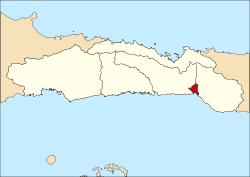 Location within Gorontalo Province | |
| Coordinates: 0°32′N 123°4′E / 0.533°N 123.067°E | |
| Country | |
| Province | |
| Founded | 18 March 1728 |
| Government | |
| • Mayor | |
| • Vice Mayor | |
| Area | |
| • Total | 79.59 km2 (30.73 sq mi) |
| Elevation | 9 m (30 ft) |
| Population (2020 Census) | |
| • Total | 198,539 |
| [1] | |
| Time zone | UTC+8 (Indonesia Central Time) |
| Area code | (+62) 435 |
| Website | www |


Gorontalo is a city and the capital of the Gorontalo Province, Indonesia. It is on the island of Sulawesi. The city has an area of 79.59 km2 and had a population of 179,991 at the 2010 Census[2] and 198,539 at the 2020 Census.[1]
Geography[]
Gorontalo shares its borders with Bone Bolango Regency (to the north and east), Tomini Gulf (to the south), and Gorontalo Regency (to the west). Its elevation does not rise above 500 metres or 1,640 feet above mean sea level[citation needed] and the average temperature is 26.5 °C or 79.7 °F[citation needed].
Administrative Districts[]
As the time of the 2010 Census, the city was divided into six districts (kecamatan), and an additional three districts were subsequently created by the splitting of existing districts. The districts are tabulated below with their areas and their populations at the 2010 Census[2] and the 2020 Census.[1] The table also includes the number of administrative villages (rural desa and urban kelurahan) in each district, and its postal codes.
| District Name |
Area in km2 |
Pop'n Census 2010 |
Pop'n Census 2020 |
No. of vill. |
Post codes |
|---|---|---|---|---|---|
| Kota Barat (West City) |
20.08 | 20,220 | 24,011 | 7 | 96131 -96136 |
| Dungingi | 4.67 | 21,568 | 25,439 | 5 | 96135 -96139 |
| Kota Selatan (South City) |
2.81 | 35,988 | 20,287 | 5 | 96111 -96115 |
| Kota Timur (East City) |
5.32 | 42,155 | 26,691 | 6 | 96112 -96119 |
| Hulonthalangi | 14.23 | (a) | 16,352 | 5 | 96111 -96117 |
| Dumbo Raya | 14.04 | (a) | 18,489 | 5 | 96112 -96119 |
| Kota Utara (North City) |
8.02 | 33,149 | 20,692 | 6 | 96121 -96123 |
| Kota Tengah (Central City) |
4.81 | 27,047 | 27,398 | 6 | 96127 -96129 |
| Sipatana | 5.05 | (a) | 19,180 | 5 | 96121 -96126 |
| Totals | 79.03 | 180.127 | 198,539 | 50 |
Note: (a) the population in 2010 of the three newly-created districts is included in the figures for the districts from which they were created.
Climate[]
Gorontalo has a relatively dry tropical rainforest climate (Köppen Af) with moderate rainfall year-round.
| hideClimate data for Gorontalo | |||||||||||||
|---|---|---|---|---|---|---|---|---|---|---|---|---|---|
| Month | Jan | Feb | Mar | Apr | May | Jun | Jul | Aug | Sep | Oct | Nov | Dec | Year |
| Average high °C (°F) | 30.8 (87.4) |
30.8 (87.4) |
31.2 (88.2) |
31.9 (89.4) |
31.7 (89.1) |
31.0 (87.8) |
30.8 (87.4) |
31.4 (88.5) |
32.1 (89.8) |
32.5 (90.5) |
32.2 (90.0) |
31.5 (88.7) |
31.5 (88.7) |
| Daily mean °C (°F) | 26.7 (80.1) |
26.6 (79.9) |
26.9 (80.4) |
27.4 (81.3) |
27.4 (81.3) |
26.8 (80.2) |
26.6 (79.9) |
26.8 (80.2) |
27.1 (80.8) |
27.3 (81.1) |
27.5 (81.5) |
27.2 (81.0) |
27.0 (80.6) |
| Average low °C (°F) | 22.6 (72.7) |
22.5 (72.5) |
22.7 (72.9) |
22.9 (73.2) |
23.2 (73.8) |
22.7 (72.9) |
22.5 (72.5) |
22.3 (72.1) |
22.1 (71.8) |
22.2 (72.0) |
22.9 (73.2) |
22.9 (73.2) |
22.6 (72.7) |
| Average rainfall mm (inches) | 101 (4.0) |
95 (3.7) |
101 (4.0) |
105 (4.1) |
148 (5.8) |
133 (5.2) |
117 (4.6) |
74 (2.9) |
67 (2.6) |
99 (3.9) |
128 (5.0) |
117 (4.6) |
1,285 (50.4) |
| Source: [3] | |||||||||||||
Infrastructure[]
The largest hospital on Gorontalo is the Aloei Saboe Hospital.[citation needed]
Culinary[]
Cuisine in Gorontalo range from seafood to corn (as these can be easily found). Famous food "binthe Biluhuta" which is made out of corn, shredded coconut, basil, and some fish or dried prawns. Other than that, grilled tuna with chilly sauce is very popular.
Sister cities[]
- Mamuju, Indonesia
- Bengkulu City, Indonesia
References[]
- ^ Jump up to: a b c Badan Pusat Statistik, Jakarta, 2021.
- ^ Jump up to: a b Biro Pusat Statistik, Jakarta, 2011.
- ^ https://en.climate-data.org/location/4806
External links[]
| Wikivoyage has a travel guide for Gorontalo (city). |
| show Authority control |
|---|
Coordinates: 0°32′N 123°04′E / 0.533°N 123.067°E
This Gorontalo location article is a stub. You can help Wikipedia by . |
- Populated places in Gorontalo (province)
- Provincial capitals in Indonesia
- Cities in Indonesia
- 1728 establishments in Asia
- Sulawesi geography stubs