Pohuwato Regency
Pohuwato Regency | |
|---|---|
Regency | |
|
Seal | |
 | |
| Coordinates: 0° 31 59 N, 121° 49 30 E | |
| Country | Indonesia |
| Province | Gorontalo |
| Capital | Marisa |
| Area | |
| • Total | 1,638.74 sq mi (4,244.31 km2) |
| Population (2020 Census) | |
| • Total | 146,432 |
| • Density | 89/sq mi (35/km2) |
| [1] | |
| Time zone | UTC+8:00 |
| • Summer (DST) | UTC+8:00 |
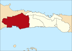
Pohuwato is a regency of Gorontalo Province, Indonesia. It is located on the island of Sulawesi. It was established in 2003 under Law Number (Undang-Undang Nomor) 6/2003. It has an area of 4,244.31 km2, and had a population of 128,748 at the 2010 Census[2] and 146,432 at the 2020 Census.[3] The seat of the regency administration is in the town of Marisa.
Administrative Districts[]
Pohuwato Regency is divided into thirteen districts (kecamatan), tabulated below with their areas and their populations at the 2010 Census[4] and the 2020 Census.[5] The table also includes the number of administrative villages (rural desa and urban kelurahan) in each district, and its postal codes.
| Name | Area in km2 |
Pop'n Census 2010 |
Pop'n Census 2020 |
Number of villages |
Post codes |
|---|---|---|---|---|---|
| Popayato (a) | 90.92 | 9,169 | 10,313 | 10 | 96466 |
| Popatato Barat (West Popayato) |
578.24 | 6,670 | 7,327 | 7 | 96467 |
| Popatato Timur (East Popayato) |
723.74 | 7,712 | 8,372 | 7 | 96467 |
| Lemito (b) | 619.50 | 10,488 | 11,306 | 8 | 96468 |
| Wanggarasi | 188.08 | 4,573 | 5,304 | 7 | 96465 & 96469 |
| Marisa (c) | 34.65 | 17,680 | 21,260 | 8 | 96365 |
| Pantilanggio | 298.82 | 8,686 | 9,763 | 6 | 96366 |
| Buntulia | 375.64 | 10,494 | 11,792 | 7 | 96363 |
| Duhiadaa | 39.53 | 10,662 | 12,793 | 8 | 96364 |
| Randangan | 331.90 | 14,995 | 16,959 | 13 | 96469 |
| Taluditi | 159.97 | 7,248 | 8,813 | 7 | 96464 |
| Paguat (d) | 560.93 | 14,967 | 16,165 | 11 | 96362 |
| Dengilo | 242.39 | 5,404 | 6,265 | 5 | 96361 |
| Totals | 4,244.31 | 128,748 | 146,432 | 104 |
Notes: (a) including 17 offshore islands. (b) including 25 offshore islands. (c) including 3 offshore islands. (d) including 3 offshore islands.
References[]
Coordinates: 0°31′59″N 121°49′30″E / 0.53306°N 121.82500°E

This Gorontalo location article is a stub. You can help Wikipedia by . |
- Regencies of Gorontalo
- Sulawesi geography stubs