Main article: 1992 United States presidential election
1992 United States presidential election in California Turnout 75.32% (of registered voters) pp pp [1]
Nominee
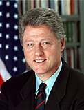
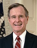
Bill Clinton George H. W. Bush
Ross Perot
Party
Democratic
Republican
Independent
Home state
Arkansas
Texas
Texas
Running mate
Al Gore Dan Quayle
James Stockdale
Electoral vote
54
0
0
Popular vote
5,121,325
3,630,574
2,296,006
Percentage
46.01%
32.61%
20.63%
County Results
Clinton
30-40%
40-50%
50-60%
60-70%
70-80%
Bush
30-40%
40-50%
50-60%
Perot
30-40%
President before election George H. W. Bush Republican
Elected President Bill Clinton Democratic
Ronald Reagan and
George H. W. Bush campaigning in California
The 1992 United States presidential election in California took place on November 3, 1992, and was part of the 1992 United States presidential election . Voters chose 54 representatives, or electors to the Electoral College , who voted for president and vice president .
California voted for Democratic presidential candidate Bill Clinton . His victory was the first time that the Golden State had voted for a Democratic presidential nominee since Lyndon B. Johnson ’s 1964 landslide, and only the second time since 1948 . Clinton's win in this state reflected the change in its status from reliably Republican to decisively Democratic. California maintains the largest number of electoral votes in the Electoral College.
It was the first occasion that San Diego County had voted for a Democrat since Franklin D. Roosevelt in 1944 , and the last time that any of the following counties have given a plurality to the Democratic nominee: Del Norte , Siskiyou , Tehama , Plumas , Tuolumne and Mariposa .[2] Ross Perot gained a plurality in Trinity County , the only time a third-party candidate has carried any county in the state since Progressive Party candidate Robert La Follette Sr. in 1924 .
California had been voting increasingly Democratic despite Ronald Reagan ’s decisive wins in his home state during the 1980 and 1984 elections. Changing demographics may have played a part in Michael Dukakis only narrowly falling short of winning California in 1988 . The early 1990s recession was blamed on George H. W. Bush , causing a rise in unemployment in construction and real estate. This ultimately gave Bill Clinton a double digit victory in California, despite Bush’s victory just four years earlier. It would vote Democratic by comfortable margins in every election since.
Results [ ]
1992 United States presidential election in California[3]
Party
Candidate
Votes
Percentage
Electoral votes
Democratic William Jefferson Clinton 5,121,325
46.01%
54
Republican
George Herbert Walker Bush (Incumbent)
3,630,574
32.61%
0
Independent
Henry Ross Perot
2,296,006
20.63%
0
Libertarian
Andre Marrou
48,139
0.43%
0
Peace and Freedom
Ron Daniels
18,597
0.17%
0
Taxpayers’
Howard Phillips
12,711
0.11%
0
America First
James "Bo" Gritz (write-in)
3,077
0.03%
0
Natural Law
Dr. John Hagelin (write-in)
836
0.01%
0
Democrats for Economic Recovery
Lyndon LaRouche (write-in)
180
>0.01%
0
Other write-ins
149
>0.01%
0
Independent
(write-in)
131
>0.01%
0
Socialist Workers Party
James Warren (write-in)
115
>0.01%
0
Independent
(write-in)
18
>0.01%
0
Independent
Isabell Masters (write-in)
12
>0.01%
0
Invalid or blank votes
242,844
2.13%
—
Totals
11,374,565
100.0%
54
Voter turnout
54.52%
—
Results Breakdown [ ] By county [ ]
County
Clinton
Votes
Bush
Votes
Perot
Votes
Others
Votes
San Francisco
72.40%
233,263
17.80%
57,352
9.01%
29,018
0.80%
2,574
Alameda
63.04%
334,224
20.62%
109,292
15.40%
81,643
0.94%
4,986
Marin
58.27%
76,158
23.32%
30,479
17.59%
22,986
0.83%
1,084
Santa Cruz
58.06%
66,183
21.86%
24,916
18.96%
21,615
1.12%
1,278
San Mateo
53.97%
149,232
27.15%
75,080
18.25%
50,465
0.63%
1,731
Yolo
53.33%
33,297
28.15%
17,574
17.73%
11,073
0.79%
492
Sonoma
52.78%
104,334
24.09%
47,619
22.19%
43,859
0.95%
1,879
Los Angeles
52.54%
1,446,529
29.04%
799,607
17.75%
488,624
0.68%
18,643
Contra Costa
50.93%
194,960
29.51%
112,965
18.94%
72,518
0.62%
2,380
Mendocino
50.21%
18,344
21.78%
7,958
26.69%
9,753
1.32%
483
Santa Clara
49.21%
296,265
28.38%
170,870
21.41%
128,895
1.00%
6,025
Solano
48.69%
64,320
29.43%
38,883
21.08%
27,851
0.80%
1,057
Humboldt
48.07%
28,854
30.49%
18,299
20.56%
12,340
0.88%
528
Monterey
47.01%
54,861
31.25%
36,461
20.97%
24,472
0.77%
895
Lake
45.44%
10,548
28.77%
6,678
24.97%
5,797
0.82%
190
Napa
45.30%
24,215
29.30%
15,662
24.60%
13,150
0.80%
428
Imperial
43.88%
11,109
38.55%
9,759
16.77%
4,247
0.80%
203
Sacramento
43.56%
197,540
35.36%
160,366
20.16%
91,412
0.92%
4,194
Santa Barbara
42.53%
69,215
35.25%
57,375
21.57%
35,105
0.65%
1,061
Fresno
42.17%
92,418
40.67%
89,137
16.56%
36,299
0.60%
1,307
San Benito
42.03%
5,354
32.28%
4,112
24.98%
3,182
0.71%
91
San Joaquin
41.28%
63,655
37.84%
58,355
20.24%
31,205
0.65%
995
Stanislaus
40.95%
52,415
36.93%
47,275
21.60%
27,651
0.52%
664
Merced
40.85%
20,133
36.48%
17,981
22.15%
10,914
0.52%
256
Siskiyou
39.91%
8,254
32.21%
6,660
26.92%
5,567
0.96%
198
Del Norte
38.91%
3,639
32.96%
3,083
27.53%
2,575
0.60%
56
Kings
38.91%
9,982
41.61%
10,673
19.10%
4,899
0.38%
97
San Bernardino
38.74%
183,634
37.24%
176,563
23.03%
109,183
0.99%
4,690
Riverside
38.64%
166,241
37.06%
159,457
23.76%
102,233
0.54%
2,344
San Luis Obispo
38.36%
40,136
34.78%
36,384
26.11%
27,314
0.75%
785
Butte
38.22%
32,489
37.18%
31,608
23.80%
20,231
0.81%
686
Tuolumne
38.12%
9,216
35.26%
8,525
26.03%
6,294
0.59%
143
Plumas
37.61%
3,742
36.17%
3,599
25.64%
2,551
0.57%
57
San Diego
37.24%
367,397
35.69%
352,125
26.28%
259,249
0.80%
7,875
Ventura
36.99%
99,011
35.46%
94,911
26.84%
71,844
0.70%
1,881
Mariposa
36.48%
3,023
35.98%
2,982
26.68%
2,211
0.86%
71
Madera
35.92%
10,863
43.20%
13,066
20.35%
6,156
0.53%
160
Tehama
35.79%
7,508
35.36%
7,419
28.05%
5,884
0.80%
168
Calaveras
35.25%
5,989
35.35%
6,006
28.53%
4,848
0.87%
148
Tulare
35.22%
31,188
45.71%
40,482
18.55%
16,430
0.51%
453
Nevada
34.92%
15,433
39.24%
17,343
25.05%
11,072
0.80%
353
Sierra
34.83%
653
36.85%
691
27.68%
519
0.64%
12
Amador
34.25%
5,286
35.49%
5,477
29.50%
4,553
0.76%
118
Yuba
34.24%
5,785
43.40%
7,333
21.53%
3,637
0.83%
140
Mono
34.19%
1,489
36.05%
1,570
28.66%
1,248
1.10%
48
Alpine
34.07%
215
35.18%
222
29.48%
186
1.27%
8
Kern
33.75%
60,510
45.05%
80,762
20.58%
36,891
0.61%
1,100
Placer
33.69%
30,783
41.92%
38,298
23.80%
21,741
0.60%
544
Lassen
32.70%
3,388
37.02%
3,836
28.99%
3,004
1.29%
134
Trinity
32.63%
1,967
31.28%
1,886
34.70%
2,092
1.39%
84
El Dorado
32.38%
21,012
39.92%
25,906
26.97%
17,503
0.72%
466
Modoc
32.19%
1,489
38.98%
1,803
27.44%
1,269
1.38%
64
Colusa
31.91%
1,798
45.94%
2,589
21.40%
1,206
0.75%
42
Inyo
31.84%
2,695
43.58%
3,689
23.62%
1,999
0.96%
81
Shasta
31.61%
21,605
41.24%
28,190
26.32%
17,990
0.84%
574
Orange
31.56%
306,930
43.87%
426,613
23.90%
232,394
0.68%
6,612
Sutter
30.48%
7,883
50.10%
12,956
18.87%
4,881
0.54%
140
Glenn
30.24%
2,666
43.24%
3,812
25.84%
2,278
0.68%
60
References [ ]
State and district results of the 1992 U.S. presidential election
Alabama Alaska Arizona Arkansas California Colorado Connecticut Delaware District of Columbia Florida Georgia Hawaii Idaho Illinois Indiana Iowa Kansas Kentucky Louisiana Maine Maryland Massachusetts Michigan Minnesota Mississippi Missouri Montana Nebraska Nevada New Hampshire New Jersey New Mexico New York North Carolina North Dakota Ohio Oklahoma Oregon Pennsylvania Rhode Island South Carolina South Dakota Tennessee Texas Utah Vermont Virginia Washington West Virginia Wisconsin Wyoming