Aïn Yagout
This article does not cite any sources. (September 2018) |
Aïn Yagout | |
|---|---|
 | |
| Nickname(s): The City of Fog, Yagout | |
 | |
 Aïn Yagout | |
| Coordinates: 35°47′N 6°25′E / 35.783°N 6.417°ECoordinates: 35°47′N 6°25′E / 35.783°N 6.417°E | |
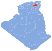
| Country | Algeria |
| Province | Batna |
| Government | |
| Time zone | UTC+1 (West Africa Time) |
| Website | ain-yagout.fr.gd |

Aïn Yaqout (Arabic: عين ياقوت · chaoui: ⵜⴰⴳⵓⵜ) is an Algerian community in Villa Batna, 35 km northeast of Batna and 75 km southwest of Constantine.
Location[]
The territory of Aïn Yagout is located to the northeast of the wilaya of Batna.
Towns of the municipality[]
The communities of Aïn Yagout are made up of 10 localities:
- Thagout
- Dahr Azem
- El Malha
- Tehawit
- Ayath Mloule
- Bir Ammar
- Draa Boultif
- Gabel
- Mechta Chorfa
- Theniet Saïda
History[]
The city of Aïn Yagout was a village located around a fountain (source of water from which the name was derived) composed essentially of [Who?]. Previously he was called Douar Sidi Ali.
In 1873, the French army decided to make it a place of cantonment. After a massive exodus of residents from neighboring villages to these places, the French decided to erect a gendarmerie barracks near the fountain
Aïn Yagout had the status of commune on January 12, 1957.
Toponymie[]
The name of the town ain yagout is an arabized toponym formed by two components: عين Aïn meaning "source" and the suffix ياقوت Yakout (or Yagout) meaning "ruby" or "hyacinth" but the origin of the appellation is Tamazight Berber Thagouth ⵜⴰⴳⵓⵜ meaning "fog"
Demography[]
Demographic evolution[]
| 1966 | 1977 | 1984 | 1998 | 2008 |
|---|---|---|---|---|
| 4 358 | 5 220 | 7 000 | 8 988 | 10 856 |
Festivals[]
- Yennayer or Yennar (Amazigh New Year).
- Thafsouth (The beginning of spring).
This article about a location in Batna Province is a stub. You can help Wikipedia by . |
- Communes of Batna Province
- Batna Province geography stubs