Boumagueur
Boumagueur | |
|---|---|
Town | |
 | |
 | |
| Coordinates: 35°30′19″N 5°33′9″E / 35.50528°N 5.55250°E | |
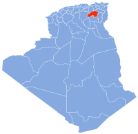
| Country | Algeria |
| Province | Batna |
| Area | |
| • Total | 111.69 km2 (43.12 sq mi) |
| Elevation | 756 m (2,480 ft) |
| Population | |
| • Total | 8,474 |
| • Density | 76/km2 (200/sq mi) |
| Time zone | UTC+1 (WAT) |

Boumagueur (Arabic: بومقر, Berber: ⴱⵓⵎⴰⴳⴻⵔ) is a town in northeast of Algeria. Area of the town is 111.69 km2, 8474 people live there, density of population is 76/km2.
The climate prevailing in this region is very dry and hot, summer extends up to six months, there is cold and rainy winter, which range from 15 days to 20 days.
Localities of the town[]
The town of Boumagueur consists of 11 localities.:[1]
- Hassoune, capital of the town.
- Ouled Bouradi.
- Chantout (College).
- Al Feidh (Ouled Sahraoui).
- Sihcine.
- Al Khoualed.
- Megounssa (south).
- Lahnanchia.
- Al Keidh.
- Lahrakta.
- Al Bourat.
- bouraguba.
- el-ghar.
Borders[]
- East: Ouled Aouf, Ouled Si Slimane.
- West: Djezzar, Barika.
- North: N'Gaous, Gosbat.
- South: Sefiane.
Languages[]
All of the inhabitants can speak Shawia.
Coordinates: 35°30′19″N 5°33′9″E / 35.50528°N 5.55250°E
References[]
- ^ Journal officiel de la République Algérienne, 19 Décembre 1984. Décret n° 84-365 .
This article about a location in Batna Province is a stub. You can help Wikipedia by . |
Categories:
- Communes of Batna Province
- Batna Province geography stubs