A1058 road
This article needs additional citations for verification. (December 2020) |
 | |
|---|---|
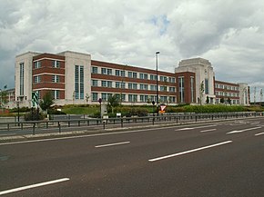 W. D. and H. O. Wills Building on A1058 | |
| Major junctions | |
| West end | Jesmond 54°58′58″N 1°36′16″W / 54.9828°N 1.6044°W |
| A167(M) A19 | |
| East end | Tynemouth 55°01′30″N 1°26′07″W / 55.0251°N 1.4354°W |
| Road network | |

The A1058 or the Coast Road is a major road in North Tyneside. It runs from Jesmond in Newcastle upon Tyne to Tynemouth, on the coast 8 miles (13 km) to the east from Newcastle City Centre. From Heaton to Billy Mill, the road is built to grade-separated dual carriageway standard. East of Billy Mill, it is known as Beach Road. Just west of Heaton, a new route was built across Jesmond Dene in the 1990s, attracting opposition from environmentalists.
The website Pathetic Motorways has speculated that a section of Newcastle's Central Motorway (A167(M)) is part of the A1058 even if it is not signed as A1058(M).[1]
The junction at Silverlink Shopping Park and Cobalt Park was upgraded using a triple-decker construction in the late 2010s at a cost of £75 million.[2]
References[]
- ^ Pathetic Motorways
- ^ "Silverlink roundabout to become 'triple decker'". ITV News. 29 June 2016. Retrieved 20 June 2021.
A roads in Zone 1 of the Great Britain road numbering scheme | ||
|---|---|---|
| ||
Coordinates: 55°00′14″N 1°31′25″W / 55.0038°N 1.5235°W
This England road or road transport-related article is a stub. You can help Wikipedia by . |
- Roads in England
- Transport in Tyne and Wear
- England road stubs