A1198 road
 | |
|---|---|
| Major junctions | |
| South end | A505 road near Royston |
| North end | Godmanchester, near Huntingdon |
| Location | |
| Primary destinations | None |
| Road network | |
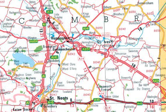
The A1198 is a road in Cambridgeshire, England, following the route of Ermine Street between the A505 at Royston, Hertfordshire and Godmanchester, near Huntingdon.[1] Along the way it passes Cambourne, the A428 and Papworth Everard.
This road was designated as a major road during road classification in 1921, and originally carried the number A14.[2] When the M11 motorway was completed, and traffic was encouraged to follow the new motorway and the Via Devana (then the A604, now the modern A14 road) instead.[3] By 1991, most of the former A14 was renumbered as the A1198, with short section of the route from Huntingdon to Alconbury being renumbered as a spur of the A604.[4]
In August 2010, Cambridgeshire County Council announced the reduction of the road's speed limit from NSL (60 mph) to 50 mph in areas where concern was raised over the safety of traffic.[1]
References[]
Route map:

| ( • help)
|
- ^ a b Cambridgeshire County Council. "A & B ROAD SPEED LIMIT REVIEW". Retrieved 18 December 2012.
- ^ "List of Class I and Class II roads and numbers". HMSO. 1923. Retrieved 18 December 2012.
- ^ "Collins Road Atlas of Great Britain". 1982. Retrieved 18 December 2012.
- ^ "1:250 000 Road Atlas". Ordnance Survey. 1991. Retrieved 18 December 2012.
A roads in Zone 1 of the Great Britain road numbering scheme | ||
|---|---|---|
| ||
This England road or road transport-related article is a stub. You can help Wikipedia by . |
- Roads in England
- Roads in Cambridgeshire
- England road stubs