A1 motorway (Tunisia)
 | |
|---|---|
 | |
| Route information | |
| Length | 247 km (153 mi) |
| Existed | 1981–present |
| Major junctions | |
| North end | Tunis |
| South end | Sfax |
| Location | |
| Major cities | Tunis, Ben Arous, Hammam Lif, Hammamet, Enfida, Sousse, El Jem, Sfax |
| Highway system | |
| |
Tunisia's A1 or A-1 motorway is a 247 km road connecting Tunis and Sfax. In the map shown, the A-1 is in red. The highway was built from Tunis at the north end toward the south and is continuing to be extended.
The A-1 is conceived of as part of an international project, sometimes called the Trans-Maghreb[1] or Trans-North Africa Highway[2] or Trans-African Highway 1 that is planned to reach from Cairo to Dakar.
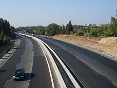
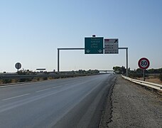
There are three lanes each way from Tunis to Hammamet then two lanes each way from Hammamet to Sfax. It is a toll road part of the way. Road signs are in Arabic and French. The speed limit on Tunisian highways is 110 km/h.
History[]
The first section connected Tunis to (near Grombalia) in 1981. It was extended to Hammamet in 1986, to Enfidha in 1994, and to Sfax in 2008.
Further construction[]
An extension south to Gabès is underway.[3] It had been planned for completion earlier but progress slowed after the Tunisian revolution of 2011.[2] Since at least 2014 the European Investment Bank has provided some financing for extensions.[4][5]
A 2013 report said: "Currently under construction, the Sfax-Gabès highway (155 km) should be completed in early 2014, with an investment of €470 m." After that, 182 km remain from Gabès to Medenine, Ben Gardane, and to Ras Jedir on the Libyan border.[2]
Distances, rest areas, and exits[]
This article contains a bulleted list or table of intersections which should be presented in a properly formatted junction table. (November 2021) |
The planned route from Tunis to the Libyan frontier is 573 km:
- Tunis-Hammamet (51 km)
- Hammamet-M'saken (92 km) with an exit at Sousse
- M'saken-Sfax (97 km) with an exit at Mahdia
- Sfax-Gabès (151 km, under development)
- Gabès-Libyan border (182 km, planned for 2018)
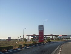
There are service areas at Grombalia, Sidi Khelifa, Borjine, and El Jem.
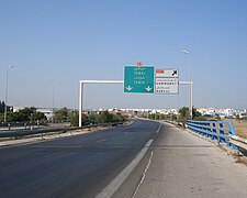
Exits and interchanges are, in order: the interchange between A1 and Olympic City November 7th, Hammam Lif, Mornag, Grombalia, , Hammamet-Nord, Golf Hammamet, Hammamet, Hammamet-Sud, Bouficha, Enfidha, Enfidha–Hammamet International Airport, Hergla, Sidi Bou Ali, Kalâa Kebira, Sousse, Sousse city center, M'saken, , Kerker, El Jem, El Hencha, and Sfax-Nord
References[]
- ^ Trans-Maghreb Highway at Programme for Infrastructure Development in Africa web site
- ^ a b c Frédéric Dubessy. Jigsaw of Trans-North Africa Highway nears completion. 21 May 2013
- ^ K. Krimi. Where are the motorway sections in progress? Interview with Mohamed Salah Arfaoui, Minister of Equipment, Housing and Territorial Development, Tunisia. L'Economiste Magrebi No. 686. 06 June 2016. (in French)
- ^ Khaled Boumiza. Tunis: Resumption of construction of the national liaison 1 / A1 via Borj Cedria. African Manager. 26 Feb 2014. (in French)
- ^ Tunisia: EUR 250 million (TND 554 million) lent for road infrastructure and SMEs. European Investment Bank news release 23 Feb 2016
Gallery[]

Exit to Turki/Grombalia

Exit to Bou Merdes
Rest area at Grombalia

A1 toll in Mornag at sunset

Exit to the Enfidha–Hammamet International Airport
Exit to Hammamet
Exit to Hergla


External links[]
- Wikivoyage:Tunisia discusses travel on Tunisian highways
Coordinates: 34°14′53″N 10°02′10″E / 34.248136°N 10.036011°E

- Motorways in Tunisia