A4135 road
 | |
|---|---|
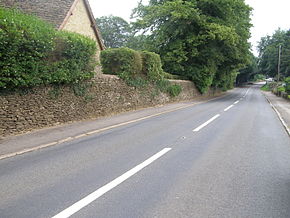 Looking east along the A4135 road in the village of Beverston | |
| Route information | |
| Length | 12.9 mi[1] (20.8 km) |
| Major junctions | |
| southeast end | Tetbury 51°38′20″N 2°09′44″W / 51.6390°N 2.1621°W |
| northwest end | Slimbridge 51°43′24″N 2°22′18″W / 51.7234°N 2.3717°W |
| Road network | |
| |
The A4135 road is a road in Gloucestershire, England, connecting the town of Tetbury with the M5 motorway and the A38 road to the west, passing through Beverston, Dursley and Cam en route to Slimbridge.
In 2001 a speed camera was installed at Dursley with an associated speed limit zone of 30 miles per hour (48 km/h).[2] The image (right) depicts a typical stretch of the A4135 road; the dry-stone wall illustrated is of considerable age.
See also[]
 Roads portal
- Slimbridge Wildfowl Trust
References[]
- ^ "Directions to New Church St/A4135". Google. Retrieved 5 April 2013.
- ^ "A4135 speed camera operation". Gloucestershire Safety Camera Partnership. Archived from the original on 31 December 2008. Retrieved 25 January 2007.
External links[]
A roads in Zone 4 of the Great Britain road numbering scheme | ||
|---|---|---|
| ||
| ||
| ||
| Road |
| ||||||||
|---|---|---|---|---|---|---|---|---|---|
| Airports and Heliports |
| ||||||||
| Rail | |||||||||
| Buses |
| ||||||||
| Waterways |
| ||||||||
| Footpaths |
| ||||||||
| Cycle paths | |||||||||
Coordinates: 51°39′59″N 2°16′56″W / 51.6664°N 2.2823°W
This England road or road transport-related article is a stub. You can help Wikipedia by . |
Categories:
- Roads in England
- Transport in Gloucestershire
- England road stubs