A5 autoroute

From Wikipedia, the free encyclopedia
A5 autoroute shield
A5 autoroute
Route information
Part of E17 E54 E511
Maintained by APRR
Length238 km (148 mi)
Existed1990–present
Major junctions
West end N104 (La Francilienne)
Major intersections A105 near Melun
A19 near Sens
A26 near Troyes
East end A31 near Beauchemin
Highway system
  • Roads in France

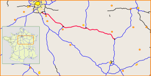
The A5 Autoroute, which was constructed in 1990 to relieve the A6, links the Parisian region with the Langres area. It is a 238 km toll road under the management of the Autoroutes Paris-Rhin-Rhône (APRR). It makes up parts of the European routes E54, E511, and E17. Before the A5 was completed, the section linking Troyes with Langres was known as the A26. This route crosses the departments of Seine-et-Marne (in the Ile-de-France region), Yonne (in the Burgundy region), Aube and Haute-Marne (in the Champagne-Ardenne region).

In Île-de-France, before reaching its western terminus at La Francilienne, the A5 splits into two branches which were previously referred to as the A5a and the A5b. They have since been renumbered, with the A5a being designated as the A5 and the A5b becoming part of the A105 (a spur route linking La Francilienne, the A5, and the town of Melun). However, the two branches are often still referred to as the "A5a" and "A5b".

Proposed Eastern Extension[]

The French Government has given the green light for the completion of the natural continuation of the A5 beyond Langres towards Switzerland and Mulhouse by granting permission for the construction of a toll motorway from Langres to Vesoul currently known as the A319 (planned opening after 2030). The remainder of the section must be supported by the State in the form of a 2 × 2 lane expressway (RN 19) connecting to the A36 between Belfort and Montbéliard and beyond to the A16 Swiss motorway. The combination of the current A5 motorway and this extension could eventually become a future A5 motorway linking Paris to Switzerland.[1]

List of Exits and Junctions[]

A5[]

Exit/Junction Destination
  La Francilienne/ N104 N6
Sinnbild Autobahnausfahrt.svg 10a  Savigny-le-Temple
Sinnbild Autobahnausfahrt.svg 10b  Savigny-Plessis, Lieusaint, Moissy-Cramayel
Sinnbild Autobahnausfahrt.svg 10c  Lieusaint, Moissy-Cramayel
Sinnbild Autobahnausfahrt.svg 11  Eastbound only Savigny-centre
Sinnbild Autobahnausfahrt.svg 12  Eastbound only Savigny - Parc d'Activites
Aire d'autoroute - station essence.png Aire du Plessis-Picard-Les Poiriers (eastbound)
Aire d'autoroute - station essence.png Aire du Plessis-Picard-Ourdy (westbound)
Sinnbild Autobahnausfahrt.svg 13  Westbound only Cesson-Vert St Denis
  A105 Marne la Valee, Melun
Aire de pique-nique.png Aire des Éprunes (westbound)
Péage.png Péage des Eprunes
Aire de pique-nique.png Aire des Éprunes (eastbound)
Sinnbild Autobahnausfahrt.svg 15  Saint-Germain-Laxis
Sinnbild Autobahnausfahrt.svg 16  Châtillon-la-Borde
Aire d'autoroute - station essence.png Aire des Jonchets-La Grande Paroisee (eastbound)
Aire d'autoroute - station essence.png Aire des Jonchets-Les Récompenses (westbound)
Sinnbild Autobahnausfahrt.svg 17  Forges
Sinnbild Autobahnausfahrt.svg 18  Marolles-sur-Seine
Aire de pique-nique.png Aire des Rasets (eastbound)
Aire de pique-nique.png Aire de Gravon (westbound)
Border between Seine-et-Marne (Ile-de-France) and Yonne (Burgundy)
  A19 Sens, Provins, Orléans
Aire de pique-nique.png Aire de Montand (eastbound)
Aire de pique-nique.png Aire de Montaphilant (westbound)
Aire d'autoroute - station essence.png Aire de Villeneuve-l'Archevêque (eastbound)
Aire d'autoroute - station essence.png Aire de Villeneuve-Vauluisant (westbound)
Sinnbild Autobahnausfahrt.svg 19  Villeneuve-l'Archevêque, Nogent sur Seine, St. Florentin
Border between Yonne (Burgundy) and Aube (Champagne-Ardenne)
Aire de pique-nique.png Aire des Tomelles (eastbound)
Aire de pique-nique.png Aire des Fontvannes (westbound)
Sinnbild Autobahnausfahrt.svg 20  Troyes-Centre, Sainte-Savine
Aire de pique-nique.png Aire de Saint-Pouange (eastbound)
Aire de pique-nique.png Aire de la Coloterie (westbound)
Sinnbild Autobahnausfahrt.svg 21  Troyes-Sud, Saint-Julien-les-Villas, Tonnerre
  A26 Lille, Reims
Aire d'autoroute - station essence.png Aire de Troyes-Fresnoy-le-Château (eastbound)
Aire d'autoroute - station essence.png Troyes-Le-Plessis (westbound)
Sinnbild Autobahnausfahrt.svg 22  Châtillon, Brienne, Bar sur Aube
Aire de pique-nique.png Aire de Mondeville (eastbound)
Aire de pique-nique.png Aire de Champignol (westbound)
Sinnbild Autobahnausfahrt.svg 23  Chateauvillain, Châtillon, Bar sur Aube
Border between Aube and Haute-Marne
Aire d'autoroute - station essence.png Aire de Châteauvillain-Val-Marnay (eastbound)
Aire d'autoroute - station essence.png Aire de Châteauvillain-Orges (westbound)
Sinnbild Autobahnausfahrt.svg 24  Chaumont, Semoutiers, St. Dizier
Aire de pique-nique.png Aire de Bois-Moyen (eastbound)
Aire de pique-nique.png Aire de Champs-à-la-Croix (westbound)
  A31Lyon-Dijon Metz-Nancy

A105[]

Exit/Junction Destination
  La Francilienne/ N104
Sinnbild Autobahnausfahrt.svg 11  Évry-Grégy-sur-Yerre
Sinnbild Autobahnausfahrt.svg 12  Moissy-Cramayel, Guignes
Sinnbild Autobahnausfahrt.svg 13  Réau
Aire d'autoroute - station essence.png Aire de Galande-la-Sablière (southbound)
Aire d'autoroute - station essence.png Aire de Galande-La-Mare-Laroche (northbound)
  A5
Sinnbild Autobahnausfahrt.svg 14  Cesson, Vert-Saint-Denis, Voisenon

European Routes[]

A5[]

European Route Location
E54 entire length
E511   A19 through   A26
E17   A26 through   A31

A105[]

European Route Location
E54 entire length

References[]

  1. ^ "Informations sur le prolongement de l'autoroute A5 sur le Forum SARA (Forum des Sites Amoureux des Routes & Autoroutes)". Archived from the original on 2016-03-03. Retrieved 2018-05-22.

External links[]

Route map:

KML is from Wikidata
Retrieved from ""