A8 road (Zimbabwe)
| A8 road | |
|---|---|
| Highway system | |
| Transport in Zimbabwe |
The A8 Highway is a paved primary trunk road in Zimbabwe running from Bulawayo to Victoria Falls.[1] It is managed by the Zimbabwe National Roads Administration (ZINARA).
Background[]
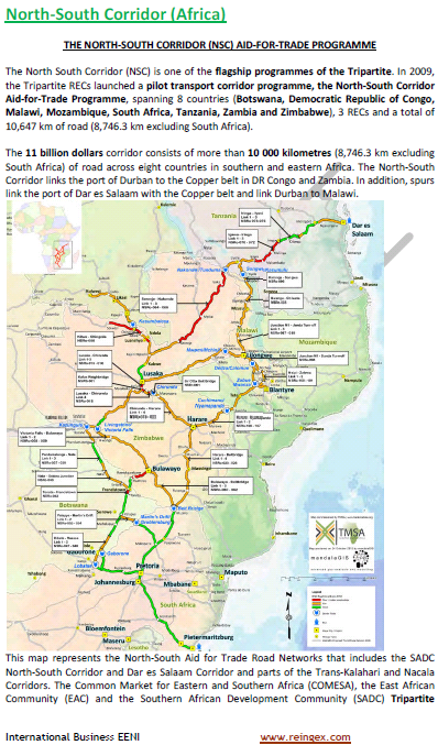
The A8 Highway is part of Zimbabwe's regional road corridor number R9 which runs from the border with Zambia to the border with South Africa. It is also part of Trans-African Highway Network no. 4 (Cairo-Cape Town Highway), which is a route designated to connect Cairo and Cape Town.
From Zambia the A8 Highway can be picked at Victoria Falls border post connecting from the "T1 Highway" from Lusaka. In Bulawayo the highway starts as "Masotsha Ndlovu Avenue" heading west, then at a round-about turns right into "Lady Stanley" which ends at the railway line, and there A8 proper begins.
Quick Road Data Table in reference to Regional Trunk Roads Network (RTRN).[2]
| RTRN No: | Road Section No: | Map Section No: | Origin | Destination | Length kilometres | Length miles | Surface | |
|---|---|---|---|---|---|---|---|---|
| SADC 15 | 708 | A8 | Bulawayo | Victoria Falls | 440 km | 273.4 miles | paved |
Operations[]
A8 is part of the Trans-African Highway 4 which is runs from Cairo to Gaborone through to Pretoria/Kimberly. The TAH 4 is 8.861 Kilometers long and the A8 covers only 440 km which is only about 5% of the trans-national road corridor. However together with the A7 Highway that runs 110 km from Bulawayo to Plumtree Border Post the Zimbabwean length of the TAH 4 becomes 550 km, which is about 6% of the total trans-national corridor.[3][4]
Junctions[]
This article contains a bulleted list or table of intersections which should be presented in a properly formatted junction table. (November 2021) |
As shown on the Automobile Association 1973 Map.[5]
Lupane Road[]
From Bulawayo the first major junction is at Lupane Turn-off 176 km away. (18°56′09″S 27°45′52″E / 18.93583°S 27.764572°E ) This right turn is the to Lupane Centre. This is the shortest trunk road in the system, only about 5 km long. The after Lupane it connects with the .
 WikiMiniAtlas
( 18°56′05″S 27°48′33″E / 18.934622°S 27.809029°E ) The runs from here to Nkayi where it continues as P8 Highway to Kwekwe via Silobela. This is the shortest route from Victoria Falls to Harare.
Halfway House[]
About 51 km from is Halfway House, 230 km from Bulawayo and 210 km before Victoria Falls. ( 18°43′47″S 27°22′15″E / 18.729815°S 27.37087°E )
Lubimbi Turn-off[]
24 km from Halfway House is Lubimbi Turn Off to the right. This road eventually reaches Magunje and the A1 Highway to Chirundu. A 4x4 truck is recommended for this route.
Dete-Kamativi Crossroads[]
About 59 km from Halfway House is the Dete-Kamativi crossroads. The left lead is the Dete Road 17 km to Dete and the right is Kamativi Road to Kamativi Mine 29 km away. About 25 km on this road is the Binga Turn-off signposted. From this point Binga is about 155 km away.
Hwange[]
Hwange is 105 km from Halfway House, 335 km from Bulawayo and 105 km before Victoria Falls. ( 18°20′49″S 26°30′14″E / 18.347021°S 26.504002°E ) In this town are Hwange Colliery Mine and Hwange Thermal Power Station.
Kazungula Road[]
Victoria Falls is 105 km from Hwange and about 3 km from the border with Zambia where the A8 Highway ends. The to Kazungula runs west for 69 km to the Border Post with Botswana and Namibia. At Kazungula transit vehicles from Botswana and Namibia into Zambia are transported by a ferry across the Zambezi River.
Bridges[]
There are a number of high level bridges o the A8 Highway and these are a few major ones on the following Rivers.[6]
(Direction is from Bulawayo to Victoria Falls)
• Umguza River • Insuza River • Bubi River • Lupane River • Shabula River • Gwayi River • Ilambo River • Kapami River • Inyantwe River • Bongora River • Lukozi River • Deka River • Matetsi River
Toll Plazas[]
The A8 is a road with tollgates at the following points.[7]
| Plaza number | Map Section Number | Trunk Road Number | Common Name | Toll Plaza | Location | Nearest Center | |
|---|---|---|---|---|---|---|---|
| 17 | A8 | Victoria Falls Highway | Cindêrella | 18°20′33″S 26°22′02″E / 18.3424°S 26.3673°E | 6 km from Hwange | ||
| 18 | A8 | Victoria Falls Highway | Umguza Turn Off | 20°00′46″S 28°32′26″E / 20.01268°S 28.5405°E | 18 km from Bulawayo |
See also[]
- A7 Highway
- Transport in Zimbabwe
- ZINARA
References[]
- ^ Google Maps Static Map Center 18.35572,26.498716 Maps.googleapis.com|Retrieved 15 April 2016
- ^ "Final Report". trademarksa.org. June 2007. p. 139. Retrieved 15 April 2016.[permanent dead link]
- ^ "Cairo Gaborone Trans African Corridor". En.reingex.com. Retrieved 2016-06-30.
- ^ "North-South Corridor (Africa)" (PNG). En.reingex.com. Retrieved 2016-06-30.
- ^ "AA Road Map of Rhodesia 1975". Rhodesia.me.uk. Archived from the original (JPG) on 4 November 2016. Retrieved 6 February 2016.
- ^ "Map Archive Rhodesia". Rhodesia.me.uk. Archived from the original (JPG) on 22 September 2015. Retrieved 17 April 2016.
- ^ "UPDATED Armfa Map" (PDF). Armfa.net. February 2015. p. 6. Archived from the original (PDF) on 2016-04-20. Retrieved 13 April 2016.
Map showing current tolling points
External links[]
- Roads in Zimbabwe