Abanda, Alabama
Abanda, Alabama | |
|---|---|
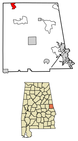 Location of Abanda in Chambers County, Alabama. | |
 Abanda Location of Abanda in Chambers County, Alabama. | |
| Coordinates: 33°06′03″N 85°31′47″W / 33.10083°N 85.52972°WCoordinates: 33°06′03″N 85°31′47″W / 33.10083°N 85.52972°W | |
| Country | United States |
| State | Alabama |
| County | Chambers |
| Area | |
| • Total | 3.01 sq mi (7.80 km2) |
| • Land | 3.00 sq mi (7.76 km2) |
| • Water | 0.01 sq mi (0.03 km2) |
| Elevation | 646 ft (197 m) |
| Population | |
| • Total | 192 |
| Time zone | UTC-6 (Central (CST)) |
| • Summer (DST) | UTC-5 (CDT) |
| ZIP code | 36276 |
| Area code(s) | 334 |
| GNIS feature ID | 112879[3] |


Abanda is a census-designated place and unincorporated community in Chambers County, Alabama, United States. Its population was 192 as of the 2010 census.[5]
History[]
Abanda was founded when the Atlanta, Birmingham and Atlantic Railroad (ABandA) was extended to that point.[6] A post office was established at Abanda in 1908, and remained in operation until it was discontinued in 1956.[7]
Demographics[]
| Historical population | |||
|---|---|---|---|
| Census | Pop. | %± | |
| 2010 | 192 | — | |
| U.S. Decennial Census[8] | |||
Abanda first appeared on the 2010 U.S. Census as a census-designated place (CDP).[9]
Economy[]
The median household income in Abanda is $13,864 which is considerably smaller than the United States average median income of $53,046. Also, versus the state of Alabama, average median income of $43,160, Abanda is approximately a third that size.[10]
References[]
- ^ "2016 U.S. Gazetteer Files". United States Census Bureau. Retrieved Jul 17, 2017.
- ^ "U.S. Census website". United States Census Bureau. Retrieved 2011-05-14.
- ^ "Abanda". Geographic Names Information System. United States Geological Survey.
- ^ "Population and Housing Unit Estimates". Retrieved June 9, 2017.
- ^ "Geographic Identifiers: 2010 Demographic Profile Data (G001): Abanda CDP, Alabama". U.S. Census Bureau, American Factfinder. Archived from the original on February 12, 2020. Retrieved June 3, 2014.
- ^ Foscue, Virginia O. (1989). Place Names in Alabama. University of Alabama Press. p. 5. ISBN 978-0-8173-0410-2.
- ^ "Chambers County". Jim Forte Postal History. Retrieved 9 February 2015.
- ^ "Census of Population and Housing". Census.gov. Retrieved June 4, 2016.
- ^ http://www.census.gov/prod/cen2010/cph-1-2.pdf
- ^ Towncharts.com
| hide Municipalities and communities of Chambers County, Alabama, United States | ||
|---|---|---|
| Cities |  | |
| Towns | ||
| CDPs | ||
| Unincorporated communities | ||
| Ghost town | ||
| Footnotes | ‡This populated place also has portions in an adjacent county or counties | |
| ||
This Chambers County, Alabama state location article is a stub. You can help Wikipedia by . |
- Census-designated places in Chambers County, Alabama
- Census-designated places in Alabama
- Unincorporated communities in Alabama
- Unincorporated communities in Chambers County, Alabama
- South Alabama geography stubs